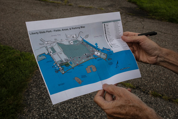
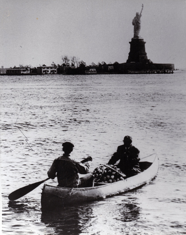
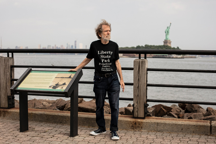
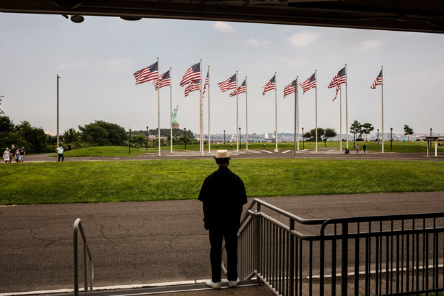
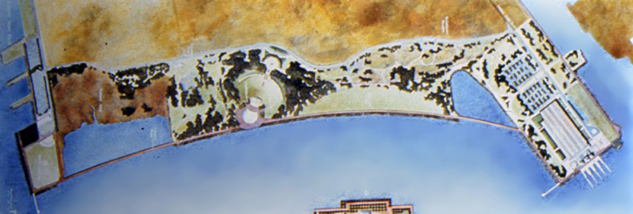
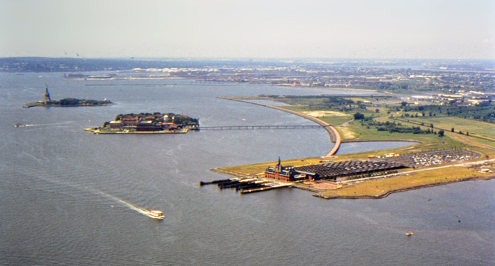
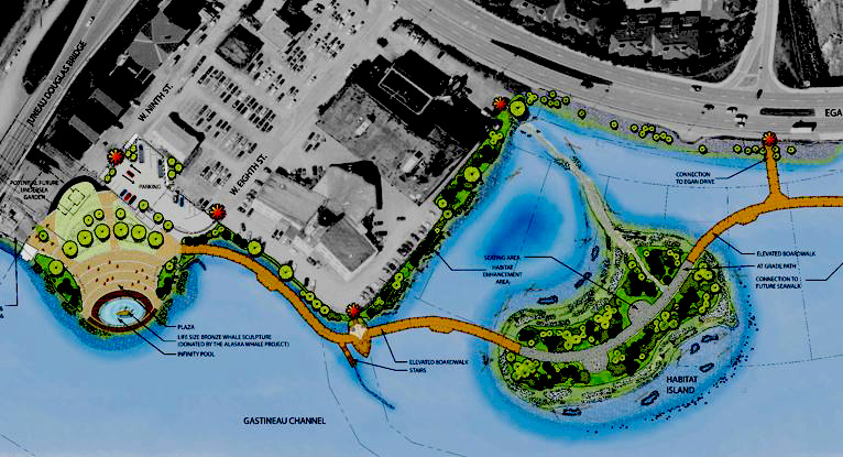
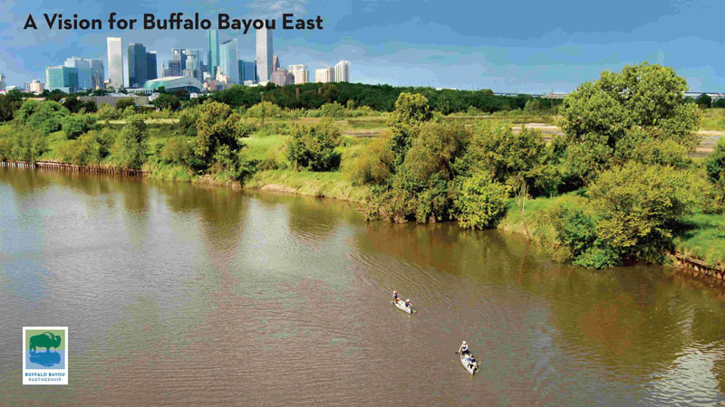
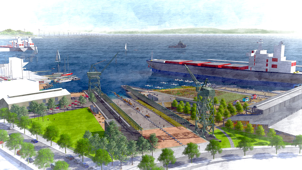
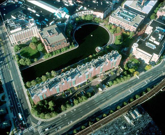
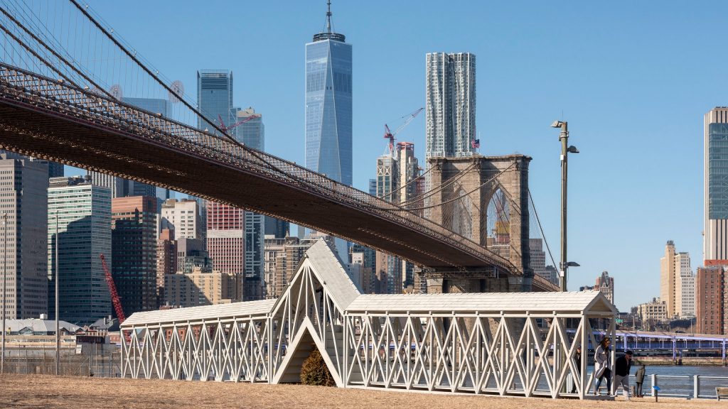
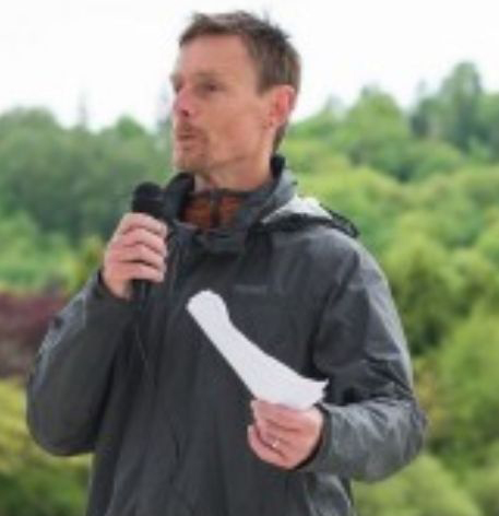
After years of often contentious negotiations Mayor
Bhalla announced in December 2022
that
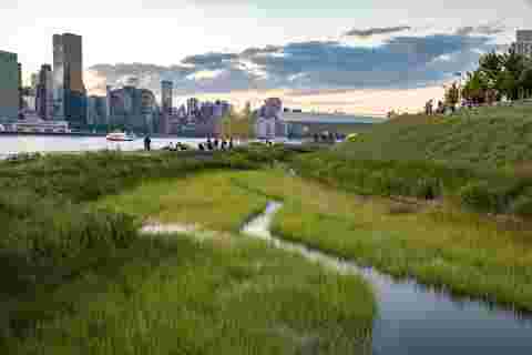
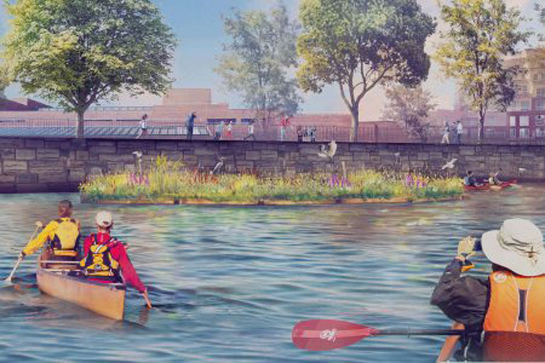
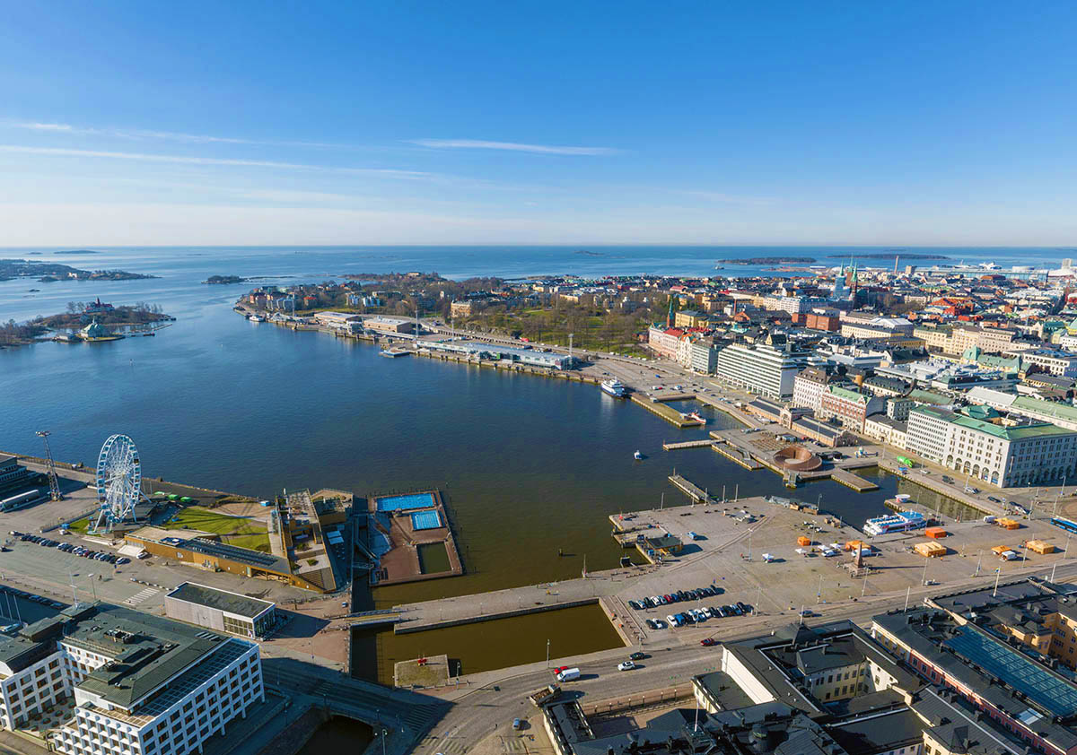
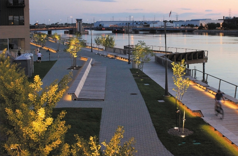
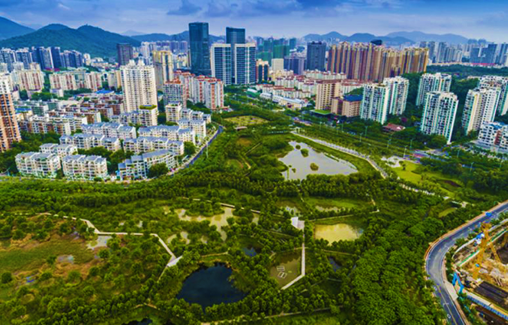
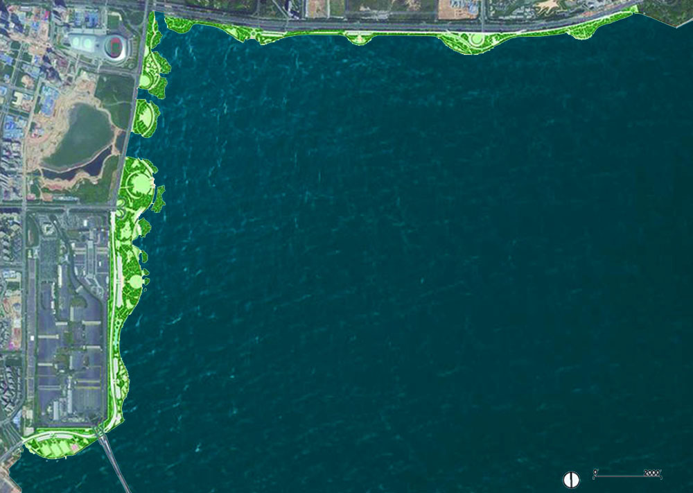
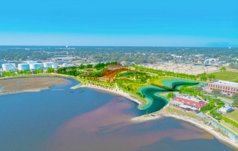
the City of Hoboken had officially acquired the 5-acre
Union Dry Dock waterfront property. The City’s ownership
of Union Dry Dock will now allow for the development of
a park at the site and connect the final piece of an
entirely publicly accessible waterfront that has eluded
Hoboken for decades. More information on the long
process that lead to this acquisition can be found
HERE.
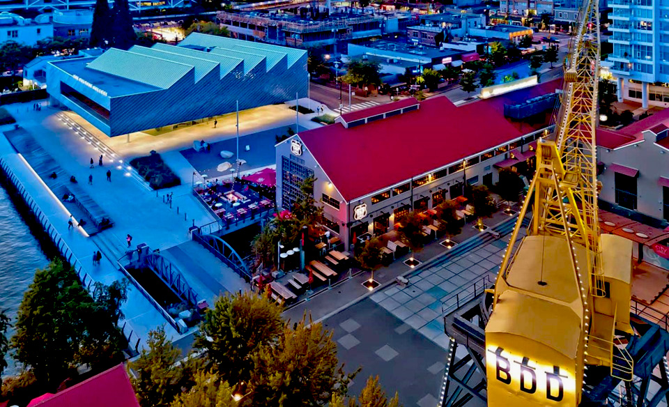
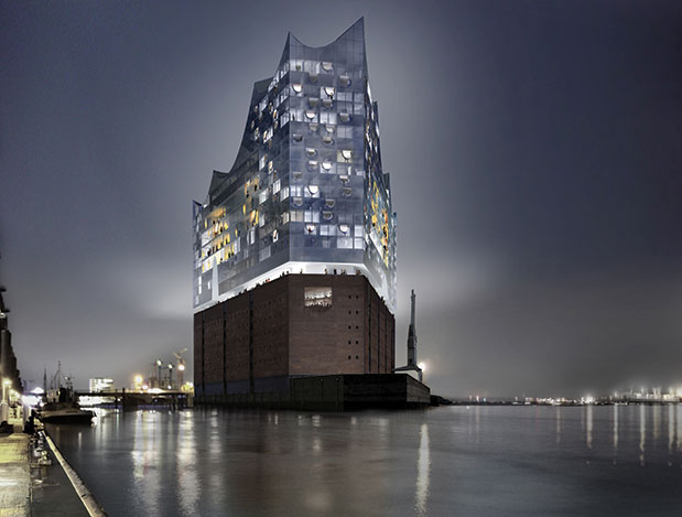
Union Dry Dock Hoboken NJ
|
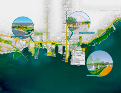
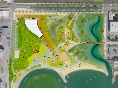
With control of the Union Dry Dock property, the Bhalla
administration will initiate a public planning process
to determine the public amenities and features that will
be located within the waterfront park. The
administration released a request for proposal (RFP) to
solicit professional design firms to present options for
the design of a public park at the property. The firm
will be tasked with working with the administration and
conducting a robust public process that will solicit
community input from residents, similar to Hoboken’s
other open space projects. The RFP can be seen
HERE. |
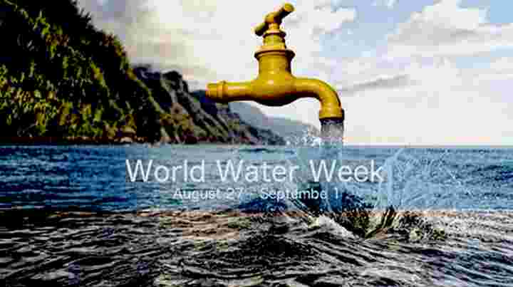
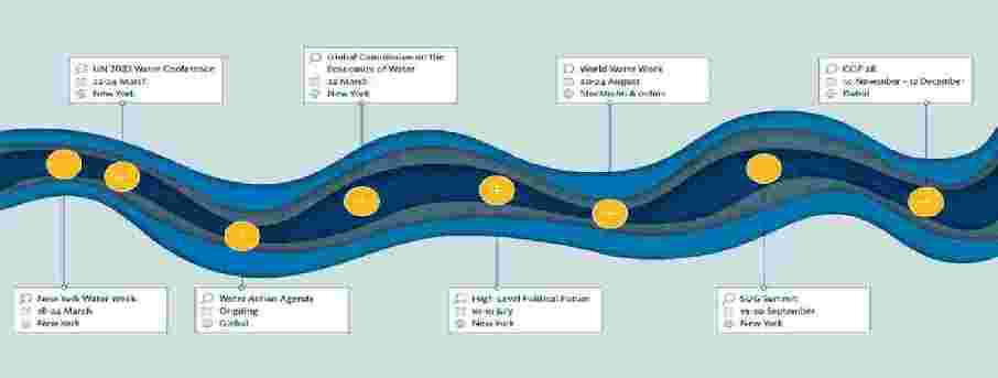
World Water Week
 |
|
World Water Week is the
leading conference on global water issues and has been
held every year since 1991. The 2022 conference took
place between 23 August and 1 September with live
presentations in Stockholm and virtual presentations
online. Organized by the Stockholm International Water
Institute (SIWI), the non-profit event is co-created
with leading organizations and attracts a diverse mix of
participants from many different professional
backgrounds and every corner of the world, -5,400
participants in 2022. |
 |
|
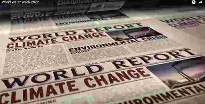
The
conference discusses solutions to the world’s greatest
water-related challenges, with topics ranging from food
security and health to agriculture, technology,
biodiversity, and the climate crisis. The theme of World
Water Week 2022 was ‘Seeing the Unseen: The Value of
Water‘, with a focus on the diverse aspects of water,
how others view and value water, and to help uncover
water’s full value to society. The Conference sessions
are now available online
HERE.
|
 |
|
Videos of World Water Week sessions are available
HERE
|
|
Thematic Scope
2022
The world’s
freshwater is under unprecedented pressure from
fast-rising temperatures, populations, and
consumption patterns. To address this global
water crisis and climate chaos, World Water Week
2022 focused on how we value water.
Valuing water is
a tool for achieving societies’ aims and
contributing to a more sustainable, peaceful and
secure future. It is also a politically-charged
topic with implications for global trade,
business models, political systems and
international law. How we value water touches on
fundamental social, cultural and spiritual
values. It paves the way for more peaceful,
stable, healthy and prosperous societies and a
more sustainable future for the entire planet.
World Water Week
web page can be seen
HERE and will
show information about the 2023 conference
scheduled for August 2023. It also includes a
sign-up link to their newsletter. Videos of the
2022 conference presentations can be seen
HERE.
|
|
World Water Week 2023 will take place on 20-24
August
and will focus on innovation at a time of
unprecedented changes when new thinking is very
much needed. The conference will have a
program
which draws on the latest scientific knowledge
and experiences from around the world. We will
explore new ways for how water can be a powerful
tool to address the water crisis, global
heating, biodiversity loss, poverty, and many
other water-related challenges. World Water Week
2023 will also be an important forum for
following
up on and advancing the commitments made at the
UN Water Conference in New York.
The 2023 Thematic Scope will be
Seeds of Change: Innovative Solutions for a
Water-Wise World. Explore
the 2023 theme .
World
Water Week 2023 will focus on innovation at a
time of unprecedented changes. Human activities
have triggered a global water crisis where we
have for the first time crossed the safe
planetary boundary for water. Yet this is only
one of multiple interlinked crises; in addition,
we must simultaneously tackle climate change,
biodiversity loss, and poverty. Water is at the
core of all these threats, which also means that
it is one of the most powerful tools to find
solutions.
|
 |
|
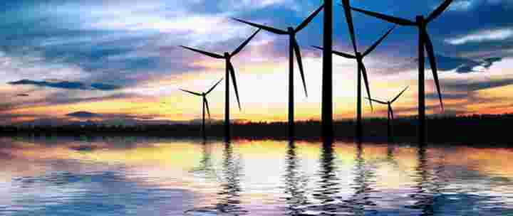
Water and Wind, Tools for the Future |
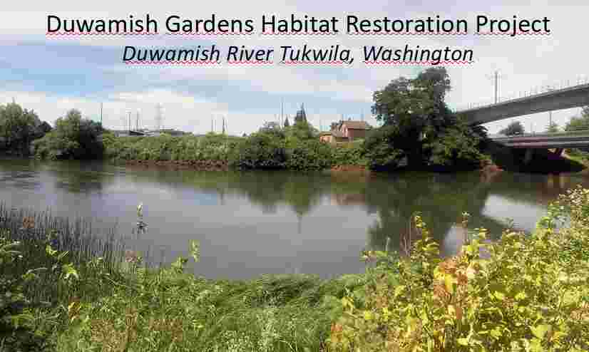
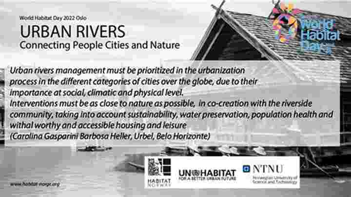
Habitat Day
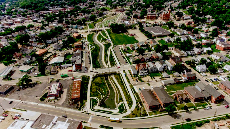
Urban Rivers |
 |
|
In October 2022
Habitat Norge held a conference on Urban Rivers
as part of World Habitat Day. The conference
sessions can be viewed
HERE.
Throughout
history, rivers have been a central feature in
the development of human societies – many of our
towns and cities are associated with rivers.
This relationship has developed because of their
social and recreational value to communities as
well as for the opportunities they present for
economic development. Rivers provide important
natural refuges and corridors between adjacent
green spaces, for both people and wildlife.
|
 |
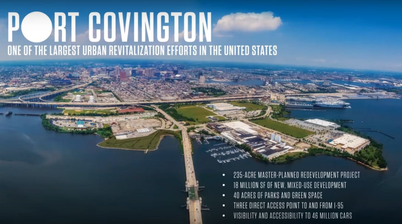
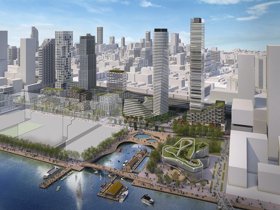
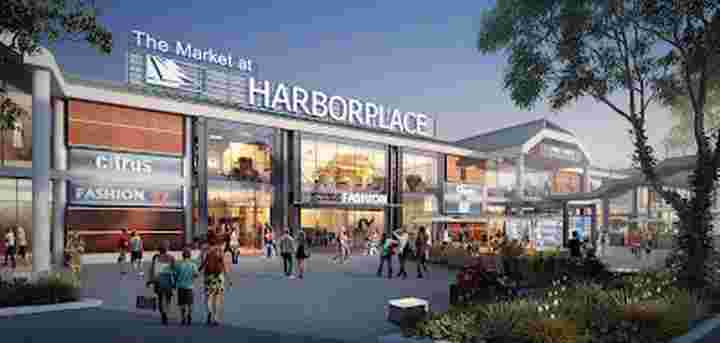
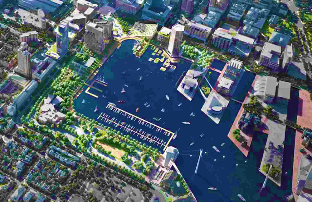
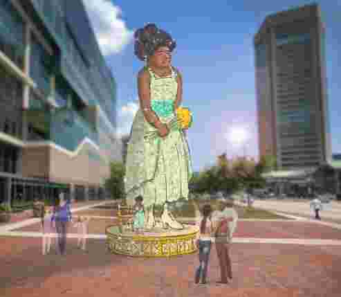
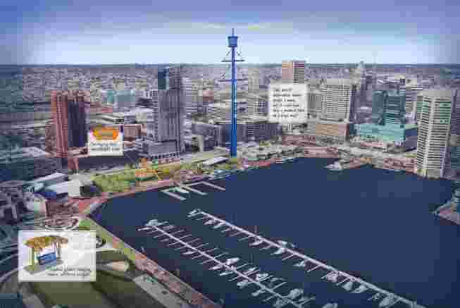
Harbor Place
Baltimore |
|
What should
David Bramble do with Harbor Place? The
implosion of Harborplace,
Klaus Philipsen,
FAIA.
The full article can be see
HERE.
A few years ago
when the
Harbor Place pavilions
showed some signs
of getting tired, few people thought it would
take more than what then operator Ashkenazy
proposed in UDAAP session #216 on November 12,
2015: An architectural face-lift for the two
pavilions and a few new tenants. The discussion
at the time revolved around a few renderings by
the architects MG2 showing steel frames, rooftop
signs and new wood paneling.
|
 |
|
MG2 Architects
UDAAP presentation rendering 2015 (MG2) |
|
Fast forward
seven years, and it is possible that the
pavilions will be razed entirely. No longer is
the debate simply about dressing up the
pavilions but whether they should be replaced
with new structures, or even highrises.
None less than
the Mayor himself announced the latest chapter
of HarborPlace in his State of the City speech
on April 5, 2022: Baltimore's fastest growing
development firm,
MCB Real Estate
is the one to
pick up the pieces. Since then the matter is
hashed out in bankruptcy court while speculation
about what could happen next is rampant.
David Bramble,
CEO of MCB keeps mum about
what he wants to do until the i's are dotted and
the t's are crossed in his purchase agreement.
He promises a listening session and public input
as soon as there is court approval, a process
that will be led by Adam Genn who used to work
for Weller Development. MCB is expected to
finalize the deal with IVL, the receiver of the
Ashkenazy property soon.
Bramble himself
called HarborPlace "Baltimore's front porch", a
somewhat awkward image considering that nobody
could ever tell exactly what was front and what
back on those pavilions which face Baltimore's
main boulevards (Light and Pratt Street) but
also the water.
|
|
|
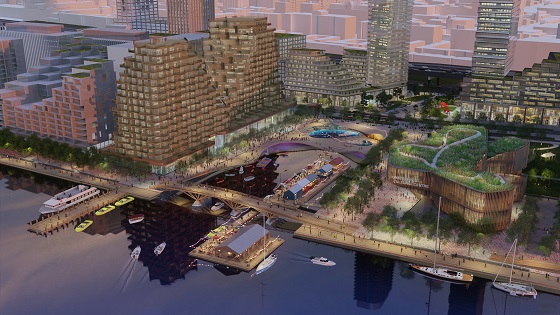
 |
|
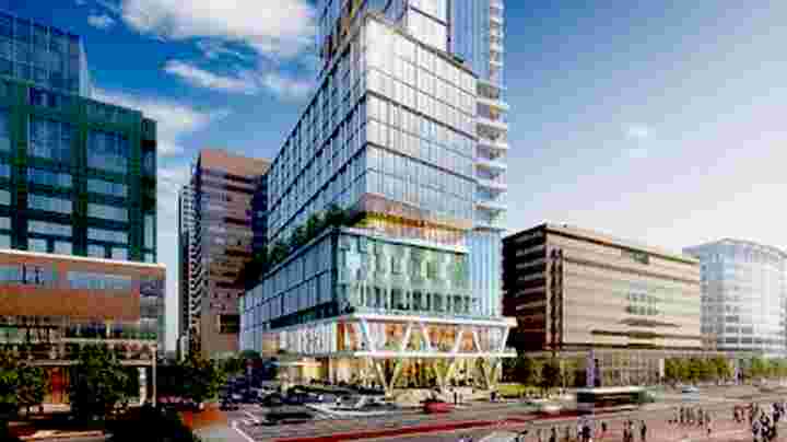
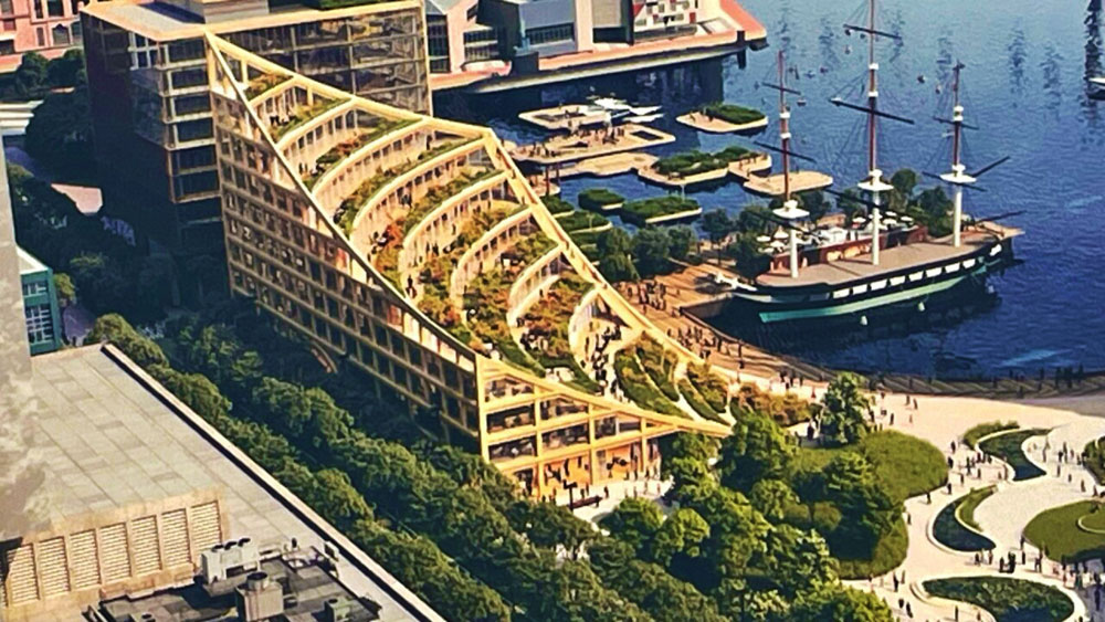
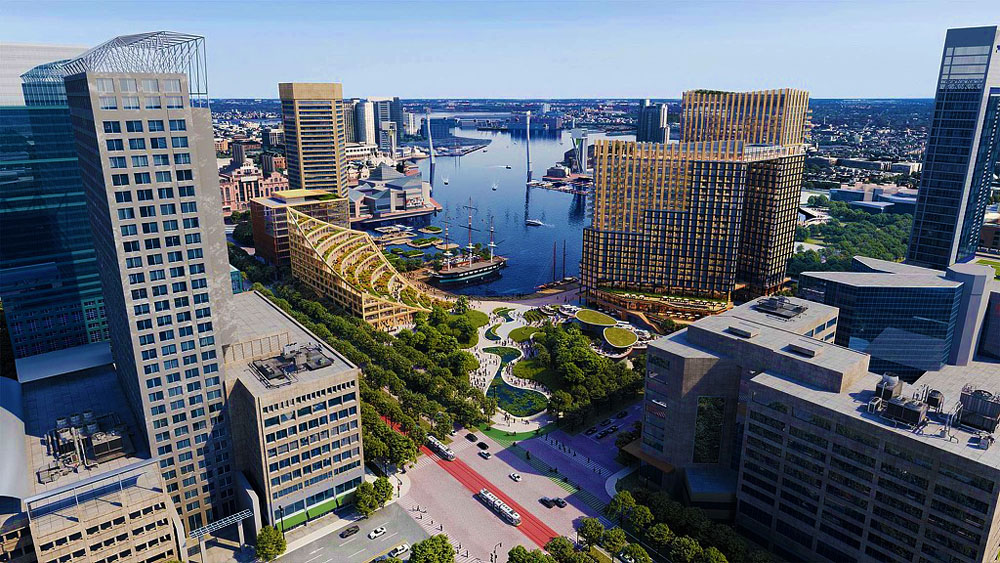
Rendering of what could happen on 300 East Pratt
Street, another MCB site. (HKS Architects) |
Greenland Ice |
|
New research is
the first to use satellite data from space to
measure water that melts off the Greenland ice
sheet during the summer. |
 |
|
Olivia Rosane
published a paper on new research by the
Centre for Polar Observation and Modelling
(see
HERE). This
study measures
the water that
melts off the sheet during the summer months
from space.
|
 |
|
Olivia writes
"the Greenland ice sheet contains enough water
to raise sea levels by 17 to 23 feet. While this
would take at least one thousand years, a new
study has found that meltwater from the
vulnerable ice sheet is already increasing flood
risk around the world.
The new research,
published in Nature Communications, is the first
to measure the water that melts off the sheet
during the summer months from space.
“Here we reported
that the runoff of surface meltwater from
Greenland raised the global sea level by one
centimetre [approximately 0.4 inches] during the
past decade,” study lead author Dr. Thomas
Slater, a Research Fellow in the Centre
for Polar Observation and Modelling at
the University of Leeds, tells Treehugger in an
email. “While that sounds like a small amount[,]
each centimetre of sea level rise will increase
in the frequency of storm-related flooding in
many of the world’s largest coastal cities and
will displace around a million people around the
planet."
|
|
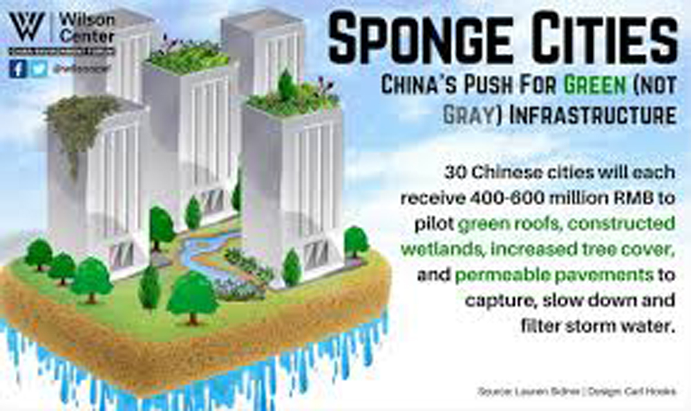
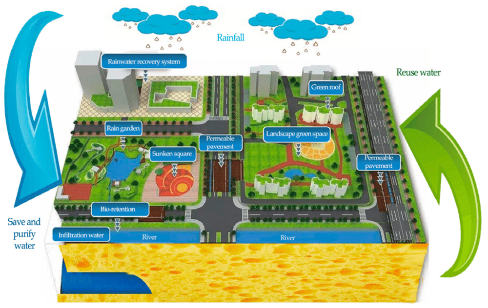
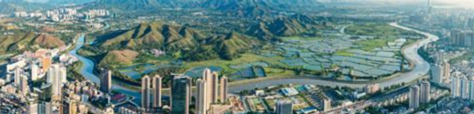
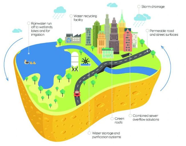
Sponge Cities
|
|
There is a new catchphrase in urban planning
that affects waterfront affairs – “Sponge
Cities”. The concept has been mainly adopted in
China where sixteen cities have been designated
to make plans to adopt sponge city principles. |
 |
The NYC Sponge by
Anand Kumar
|
|
Yichun
Xu from
the Shanghai studio of Chapman Taylor defines
sponge cities in her paper on the subject (see
HERE)
as
follows:
A
sponge city is an urban area which has been
designed to cope with excess rainfall using a
variety of techniques.
|
 |
|
Reducing the number of hard surfaces and
increasing the amount of absorbent land,
particularly green space, can make a significant
difference in reducing the severity and
frequency of flooding events. Supplementing this
approach with efficient channeling and storage
systems can help to counter the frequency of
water shortages, which can be particularly acute
in large cities. |
 |
|
Other measures can include:
-
The provision of rooftop green spaces.
-
The storage and harvesting of rainwater.
-
Building roads with porous surface
materials.
-
The use of water-intensive plants and trees.
-
Creating land basins to hold excess water.
Introducing more ponds and lakes which can hold
some of the excess water.
|
 |
|
The concept is not really new. The provision of
vegetated open space in river floodplains and
coastal areas has long been known to mitigate
flooding and erosion, though not always
practiced, but this collection of water
management practices into a memorable name could
help to realize more of these practices on the
ground. |
|
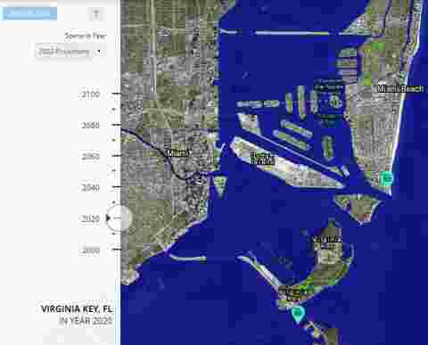
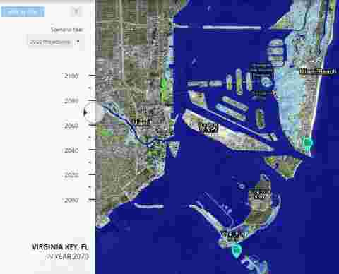
Massachusetts Sea
Level Affecting Marshes Model (SLAMM)
|
 |
|
SLAMM is a
mathematical model developed by
Warren Pinnacle Consulting, Inc.,
to simulate the potential impacts of long-term
sea level rise on wetlands and shorelines. Data
representing elevation, tidal range, accretion,
erosion, and freshwater parameters (among
others) are used to model the dominant processes
involved in wetland conversion (e.g., salt marsh
becomes tidal flat, or inland freshwater marsh
becomes tidal freshwater marsh) and other forms
of shoreline modification.
|
 |
|
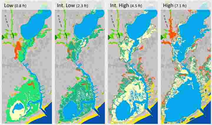
Sample maps of SLAMM results
show potential wetland
distribution in 2100 for Parkers
River, Yarmouth, under the four
sea level rise scenarios. Green
and orange colors indicate marsh
or swamp, yellows indicate tidal
flat or beach, and blues
indicate open water.
|
|
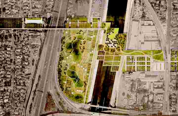
The Los Angeles River in Flood
|
More information abpout this
model can be seen
HERE.
|
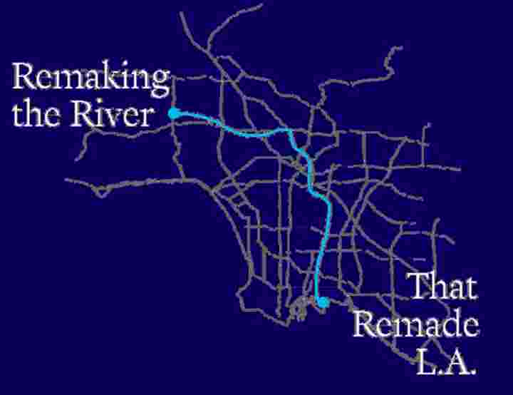
Remaking the River That Remade
LA
|
 |
|
Michael Kimmelman, the
architecture critic of
The New York Times,
wrote an article about the
remaking of the Los Angeles
River. The full article can be
read
HERE.
|
 |
|
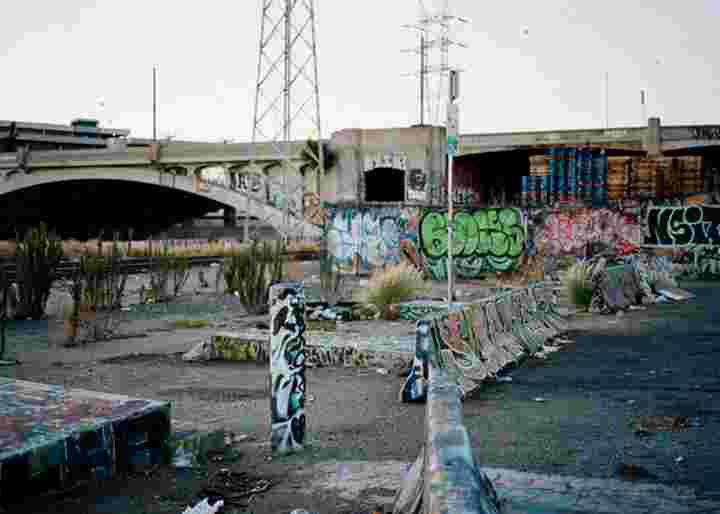
The Los Angeles River Photo by
Adali Schell |
|
At 51 miles long, the Los
Angeles River is one of
America’s largest infrastructure
projects. Angelenos live, work
and play along it, but know
little of its origins nor its
role in protecting them from
devastating flood waters.
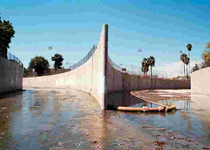
The Los Angeles River was never
a storybook river of the kind
that, like the Hudson or the
Seine, we associate with great
cities. It was an arid,
Janus-faced watercourse — most
of the time hardly more than a
shallow, burbling brook, which
ran underground in places and
occasionally turned bone-dry.
But with heavy rains, it was
prone to flooding, occasionally
gaining the full, deadly force
of the Mississippi or the
Colorado and violently
overreaching its low banks.
|
 |
|
The Los Angeles River in Flood |
|
In June, the Los Angeles County
Board of Supervisors approved
the first new master plan for
the river in more than a
quarter-century. Like all master
plans, it lacks legislative
teeth and has its share of
detractors. But it is the most
ambitious vision for the river
since the channel was
constructed, forward-looking and
socially minded — a blueprint
for encouraging legislators,
private developers and community
groups to come together around
financing and new laws. |
 |
|
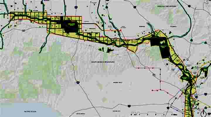
LA River Master Plan
|
|
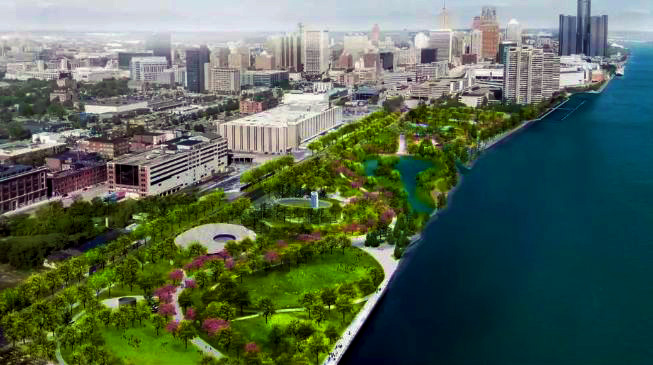
Among the projects the master
plan endorses is a proposal by
the architect Frank Gehry for
that southern stretch of the
river. Collaborating with the
landscape architect Laurie Olin
and the engineering firm
Geosyntec Consultants, Gehry
imagines building platform parks
levitated above the concrete
channel at the river’s
confluence with the Río Hondo
and a new $150 million
Gehry-designed cultural center
beside the parks. |
 |
|
Proposed Frank Gehry and Laurie
Olin elevated park over the LA
River |
|
Some of the opposition to the
master plan and to Gehry’s
proposals comes from
environmentalists who are
pressing for a more natural
version of the river. Among the
naysayers is a venerable
organization called Friends of
the Los Angeles River,(FOLAR).
FOLAR stated that the goal
should not be building decks
over the concrete channel but
looking at removing it,
installing permeable pavement
and capturing more storm water. |
 |
|
Friends of the Los Angeles River
reclamation preference
|
|
Just as FOLAR doesn’t believe
that the county and Olin have
fully considered alternative
scenarios, the county and Olin
insist FOLAR is ignoring the
basic science. For his part,
Gehry told me he also hoped to
remove the concrete but the
facts didn’t allow it. I
thought, Well, the river runs
through all these different
communities, maybe we could make
a great park out of it if we got
rid of the concrete — which
seemed a beautiful idea, a
51-mile garden — and so we
worked on that plan for two
years, pro bono, because I
simply refused to believe it
wasn’t possible. He and his
partner on the project, Tensho
Takemori, couldn’t figure out
how to engineer the concrete
away. |
 |
|
LA River channels Photo Adali
Schell
|
|
|
|
|
The Waterfront Center
October 2022 Newsletter
|
|
|
|
In 1981Ann Breen and Dick Rigby
founded the Waterfront Center, a non-profit
organization, to promote good waterfront planning and
design. A short video, see
HERE, illustrates the ways in which the Waterfront
Center has pursued this promotion. Over the years the
Waterfront Center has become a major influence in the
improvement of city waterfronts in many countries,
championing the transition from decaying waterside
industry to vibrant mixed-use waterfronts.
|
|
|
In January 2022 Ann Breen died
after a short illness to the dismay of her many
admirers. After the first shock of their loss, they
began to discuss what could be done to continue the
formidable organization that Ann had created, how Ann’s
methods of bringing an inter-disciplinary review of the
best waterfront planning and design could be continued
into the future.
The Waterfront Center website (see
HERE) is a digital archive of much of the Waterfront
Center’s work and will continue to be posted, but this
records the past and the discussion has centered on the
future. This newsletter is the first step in continuing
the work of the Waterfront Center. Waterfront Center
Correspondents have
agreed to contribute news of waterfront events
and reports of Waterfront Center activities quarterly
and to distribute these as a newsletter and on the
website. If you would like to add content to these
newsletters or wish to be added to the distribution list
contact Kathy Wine or Charlotte De Witt
HERE.
This is the first of these
quarterly newsletters.
|
|
|
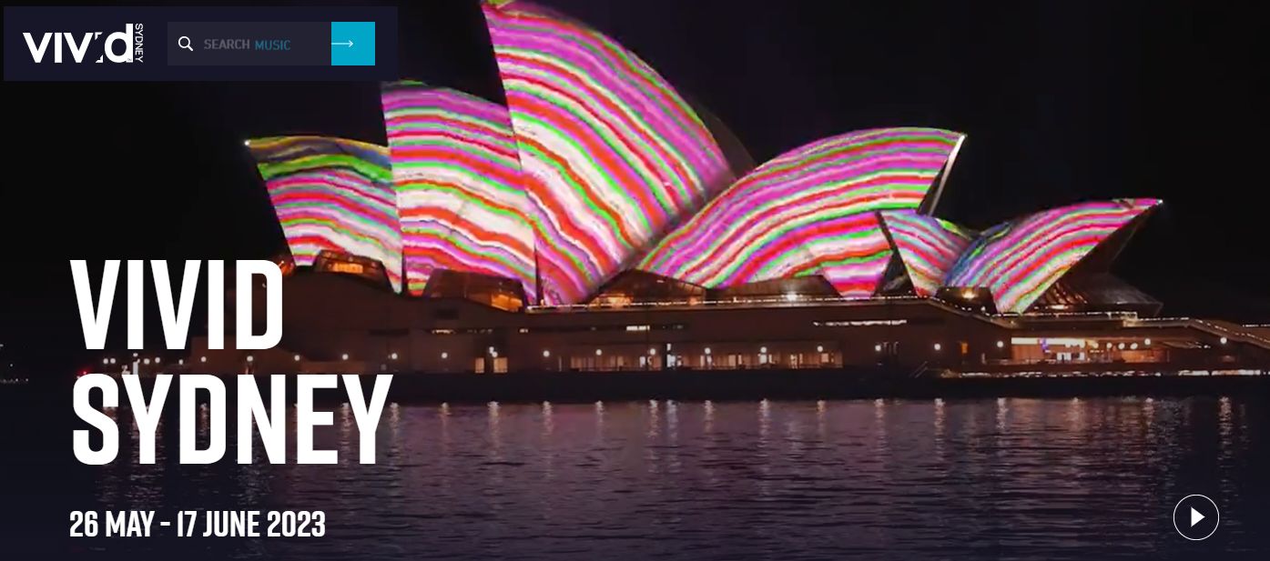
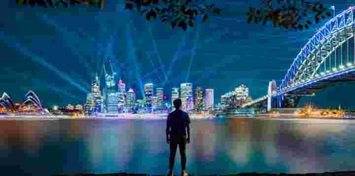
The
Sydney Opera House lit up for Vivid Sydney
|
|
|
Vivid Sydney is an annual
celebration of creativity, innovation, and technology,
which transforms Sydney for 23 days and nights. In 2022,
for its 12th year, Vivid Sydney fused art, innovation,
and technology in collaboration with some of the most
boundary-pushing artists, thinkers, and musicians of our
time.
Visit
HERE for details
|
|
|
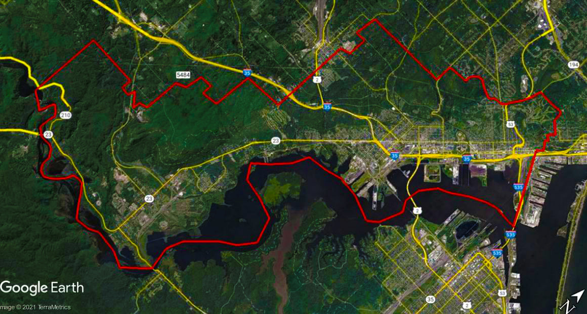
The St. Louis River Corridor
Initiative in Minnesota invests in public park and trail
improvements from Lincoln Park to the Fond du Lac
neighborhood. The overall goals of the Initiative are to
support the natural environment, enrich neighborhood
quality of life, attract new home buyers, establish new
visitor destinations, and stimulate appropriate
development. Initiative projects are funded in part by
$18 million in bonds, collected through the ½ and ½
tourism tax approved by the Minnesota Legislature in
2014. These funds will leverage additional dollars
through community partnerships and grants.
For a comprehensive review of the
Initiative, including project updates, please see our St.
Louis River Corridor Initiative 2021 Progress Report.
|
|
|
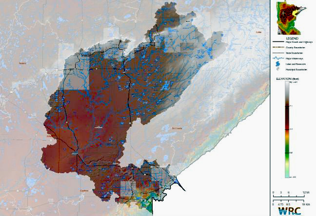
St.
Louis River: Superior Waterway
|
|
|
St.
Louis Major Watershed
|
|
|
The call of the wild may be no
stronger anywhere in the lower 48 states than the
headwaters of the St. Louis River. Beginning in the
Laurentian Uplands, where small streams divide in three
directions toward Hudson Bay, Lake Superior, and the Mississippi
River, it’s a land of timber wolves, moose, and
Canada lynx. Wood turtles, sturgeon, walleye, northern
pike, bass, bluegill, black crappie, channel catfish,
and 163 species of breeding birds call the river home,
savoring lush wetlands and wild rice lakes that led the
Ojibwa people to settle the region.
This 194-mile river, which drains
2.4 million acres of Minnesota’s northern forests and
wetlands, remains the primary reservation fishery for
the Fond du Lac Band of Lake Superior Chippewa. Below
the reservation, it flows through the magnificent Jay
Cooke State Park and into a rare freshwater estuary
between the twin ports of Duluth, MN, and Superior, WI,
where it enters Lake Superior as the largest U.S.
tributary of the entire Great Lakes system. The lower
St. Louis is the only river in the state with whitewater
rafting opportunities.
See the Progress Report
HERE.
|
|
|
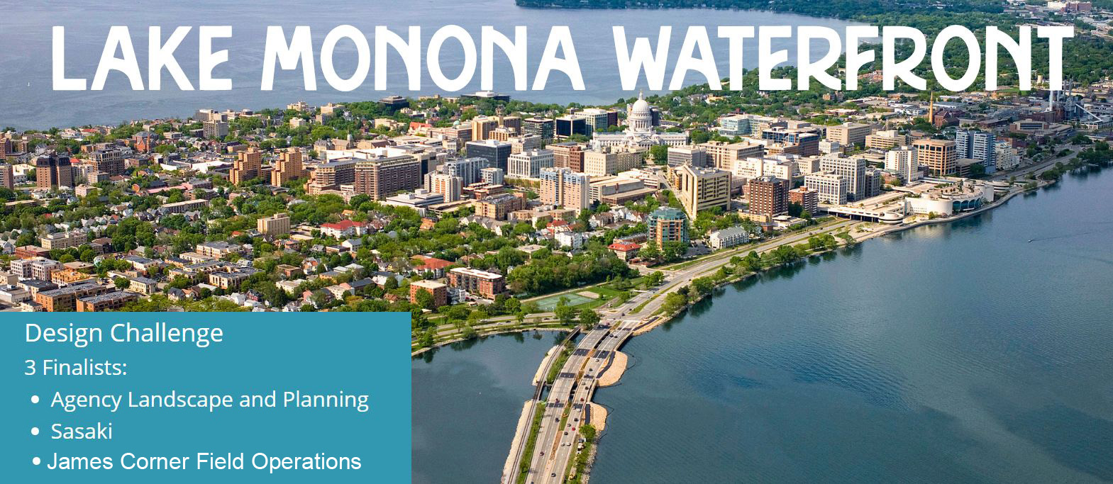
Three Finalists Chosen
for Lake Monona Waterfront
|
|
|
The Lake Monona Waterfront Design
Challenge (see
HERE) is a competition to create a visionary,
inclusive, and environmentally focused master plan for
1.7 miles of shoreline and 17 acres of Madison
Wisconsin's foremost public lakefront. The Design
Challenge process started in March 2022.
The Lake Monona Waterfront Ad-hoc
Committee completed its evaluation of fourteen design
team RFQ submissions and five interviewed teams. The top
scoring teams are Agency Landscape and Planning, James
Corner Field Operations, and Sasaki. The experience and
expertise the selected teams bring to the master
planning process are significant, with each team
providing a unique perspective on plan development. The
Ad-hoc Committee is reviewing the design challenge scope
of services, and once finalized, the City will contract
with each team to participate in the challenge. More
details on the scoring can be seen
HERE.
|
|
|
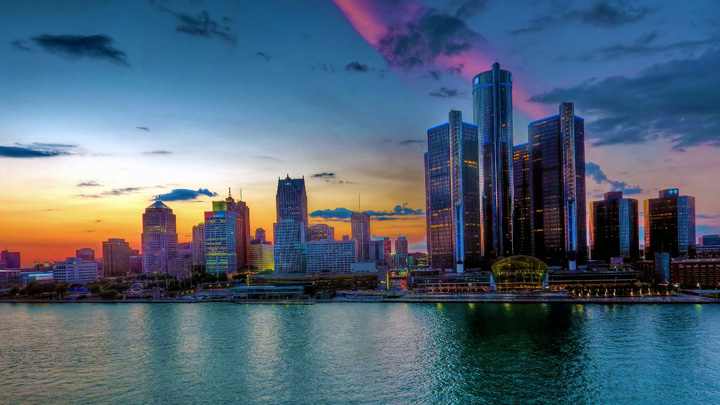
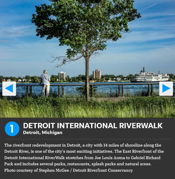
USA TODAY ANNOUNCES DETROIT
RIVERWALK AS THE BEST RIVERWALK IN AMERICA
Friday, May 6, 2022
DETROIT, Michigan, (APRIL 22,
2022) -The Detroit Riverfront Conservancy is excited to
announce the Detroit Riverwalk has been named Best
Riverwalk in the 2022 USA TODAY 10Best Readers' Choice
Awards contest. It is the second year in a row that the
Detroit Riverwalk has been recognized as the Best
Riverwalk in the country.
“We are thrilled to be voted
number one for the second year in a row,” said Matt
Cullen, board chairman of the Detroit Riverfront
Conservancy. “This is going to be a big year for us as
we break ground on new projects, mark the completion of
our East Riverfront vision and make plans for our
20-year anniversary in 2023, so it is incredibly
rewarding to be able to celebrate the Best Riverwalk
honor during this special year.”
“The entire Detroit Riverfront
Conservancy team is proud to be recognized again on this
national level,” said Mark Wallace, president and CEO of
the Detroit Riverfront Conservancy “This honor is also
very exciting because we are being recognized as the
Best Riverwalk based on the votes submitted by people
throughout our community who voted for us. Detroiters
love their riverfront.”
For more details see
HERE
|
|
|
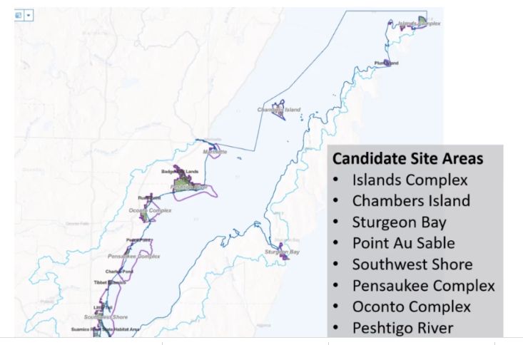
Green
Bay National Estuarine Research Reserve
|
|
|
Green Bay, Wisconsin, is the
world's largest freshwater estuary and the concept of
siting an NERR in the Bay has been in discussion for
some years. New National Estuarine Research Reserves are
designated through a six-step process that typically
takes 4-6 years to complete. The first step was taken
with a letter from the Governor’s office to NOAA on
March 25, 2019. A response from NOAA was issued July 19,
2019, advancing the initiative and completing step one
of designation. The Green Bay NERR is currently in step
two of the designation process, the evaluation of
potential sites. This stage includes broad-reaching
public outreach and stakeholder engagement; establishing
the criteria used to select a site; the determination of
candidate sites; and the nomination of a final site to
the National Oceanic and Atmospheric Administration
(NOAA). See the Site Selection & Timeline for more
details.
Upon designation, the Green Bay
NERR would be the third National Estuarine Research
Reserve within the Great Lakes, and the sole
representative for the Lake Michigan-Huron biogeographic
region. Existing NERRs within the Great Lakes include
the Lake Superior National Estuarine Research Reserve,
established in 2010 and located in Superior, Wisconsin,
and Old Woman Creek NERR, established in 1980 along the
Ohio shoreline of Lake Erie.
For more information see
HERE.
|
|
|
Candidate Areas for the National Estuarine Research
Reserve
|
|
|
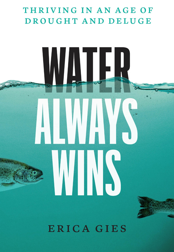
BOOK
REVIEW: WATER ALWAYS WINS by Erica Gies
|
|
|
Water
Always Wins See
HERE
|
|
|
|
How do we survive in an age of
drought and deluge?
Water Always Wins by Erica Gies is an examination
of the critical waterfront issues that cities are facing
and offers hopeful and innovative solutions that are
happening around the world to address disruptive climate
change.
It begins with current problems
that we are creating with water and then moves into a
“Slow Water Movement” of nuanced solutions. Examples are
not comprehensive, but intended as a solid range of
efforts being made in the US, Canada, Iraq, UK, India,
Peru, China, The Netherlands, Kenya, and Vietnam. Every
coast is unique, but all face common challenges.
As a science journalist, Erica
spans the globe to cover the natural and cultural
histories of water use. She offers ancient lessons from
Peru such as the use of amunas to extend water supply in
the dry season. With an historical perspective, she
outlines the long term negative effects in controlling
water such as building seawalls and megadams.
|
|
|
Inca
Amunas Photo by Borgen Magazine
|
|
|
Erica advocates for alternative
solutions to let water flex and be its true nature.
Humans are inclined to build seawalls to protect from
incoming seas that require constant and costly
maintenance, but natural coastal ecosystems such as
tidal marshes, barrier islands, coral reefs, estuaries
can sustain themselves.
In Vietnam, salt water is moving
up the Mekong Delta due to lost mangroves, sea level
rise, and upstream dams. In response, Vietnam is
diversifying crops and restoring mangroves.
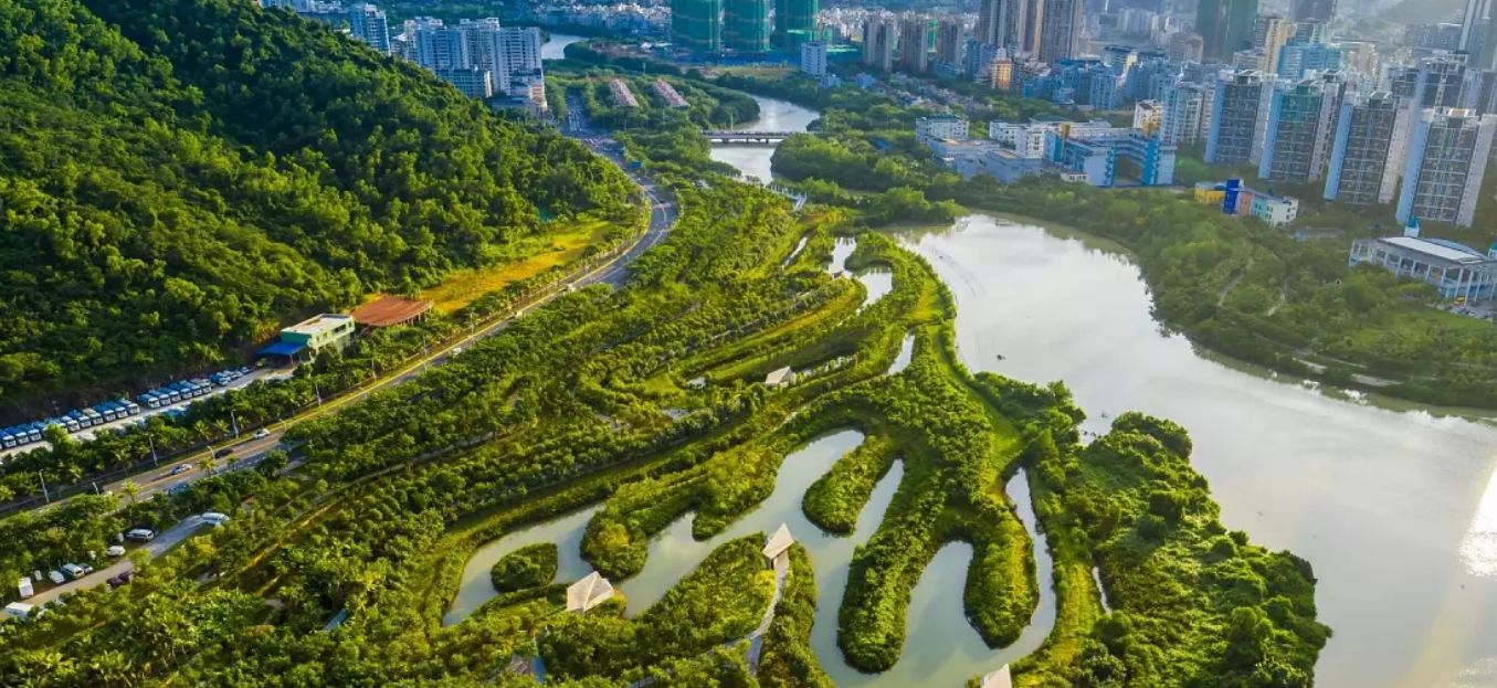
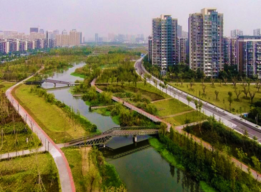
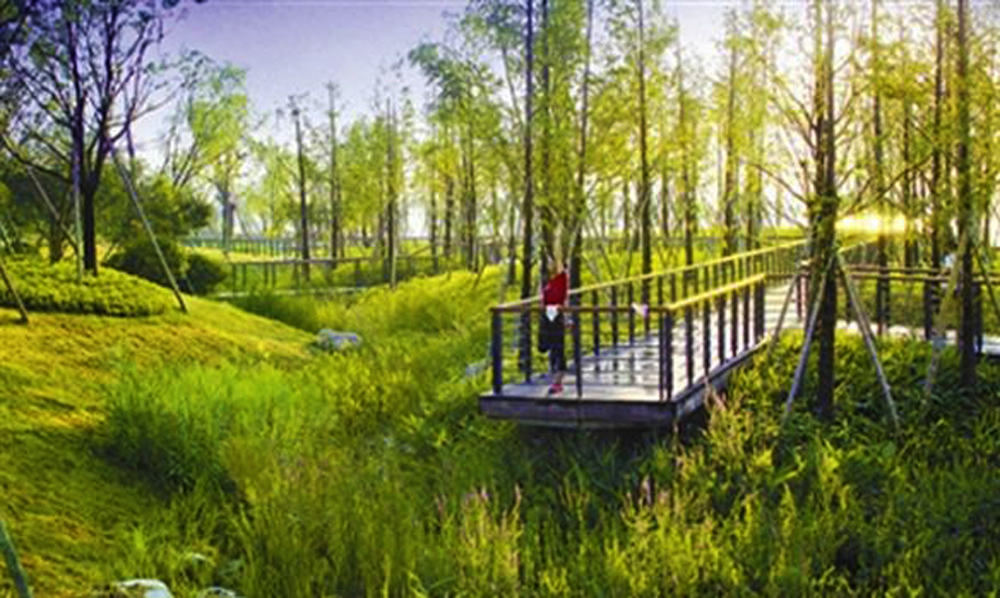
After years of significant
flooding in China’s cities, landscape architect, Yu
Kongjian has led several projects with his firm
Turenscape that aim to slow water. China’s leaders have
adopted a “Sponge City Revolution” to make room for
water in cities.
|
|
|
Sanya
Mangrove Park, an Example of Turenscape's Sponge Cities
|
|
|
As a global leader in water
management, The Netherlands has created an Agenda of
International Water Affairs to share their expertise
with other governments around the world. They are not
advocating for Slow Water to replace engineered water
systems, but rather to have natural systems augment what
has been done. The Dutch have a long history of building
dikes (levees) to protect low lying land and are experts
at understanding the consequences and need for changing
approaches. In the mid-1990’s, they adopted a Room for
the River program to remove or lower dikes to reconnect
some stretches with their floodplains. In 2017, they
updated their Water Law to “manage” risk from floods
rather than simply prevent them.
|
|
|
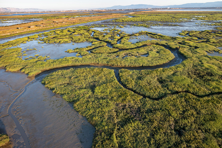
In recognizing the importance of
wetland restoration for decades, San Francisco Bay
restoration is well on its way to restoring more than
90% of its wetlands lost to development. However, with
the acceleration of climate change, tidal marshes are
only the first line of defense so a further
comprehensive approach is needed.
|
|
|
San
Francisco Bay Restoration
|
|
|
There is much more in this book to
learn from for planning and advocating for the future of
urban waterfronts.
- Diane Norris
|
|
|
Apres Nous le
Déluge
Some
Postdeluvial Thoughts
|
|
|
By Stewart McKenzie Waterfront Center WebMaker
|
|
|
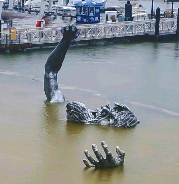
The
Giant, Photo by PRK Network
|
|
|
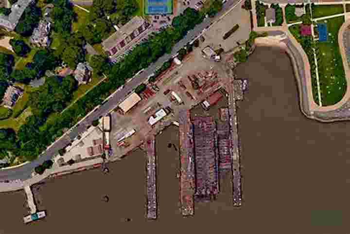
When Ann Breen and Dick Rigby first started the
Waterfront Center in 1981 the main issue was how to
promote public access and mixed waterside uses in urban
waterfronts. Typically, access to the water’s edge in
American cities was blocked by decaying waterfront
industry, rotting piers, abandoned warehouse , and
disused railroads.
Now, forty-one years later, this issue has largely
disappeared, and the value of urban waterfronts has been
clearly recognized. Now the main short-term issue is how
to protect public water access and waterfront open space
uses from fierce competition to develop the water’s edge
for profitable private uses.
Looming over these short-term issues however, is the
much greater problem of global climate change. The
heating of the planet is causing sea level rise and
increased storms and floods. These problems will
increase in the future. In the past these issues have
received some consideration in the Waterfront Center
awards process but many of the projects that have
received awards will be underwater in our children’s
lifetime. When judging future waterfront plans and
projects, the durability of siting clearly needs to be a
major consideration.
This paper looks at the gravity of the sea level rise
and flooding problems worldwide, identifies ways of
monitoring the problems both regionally and locally,
discusses criteria that can be used to assess the degree
to which plans and projects can withstand future
flooding, and proposes that the Waterfront Center should
adopt as its primary future mission the promotion of
sustainable waterfront plans and projects that can
survive climate change.
|
|
|
The
Gravity of the Problem
|
|
|
Greenland Sea Ice Melting Photo by CNN
|
|
|
The
Greenland sea ice is melting. If all global carbon
dioxide emissions were stopped tomorrow global sea level
would rise about a foot from Greenland meltwater. With
continued CO2 emissions and ice melt from Antarctic ice
and glaciers, sea level rise could be 3.5 to 7 feet by
the end of the century. Historically the world’s major
cities have developed on coasts or major rivers for
mercantile ship access, and all are vulnerable to sea
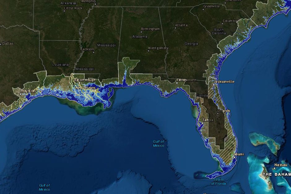
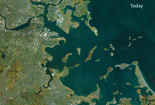
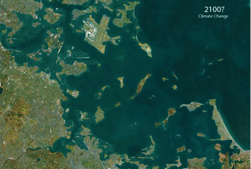
level rise. If all the ice caps melted, the world would
look like the map below, the dark land areas being
underwater.
|
|
|
Map created by Richard Weller, Claire Hoch, and Chieh
Huang
|
|
|
And the map of North America could look like this:
|
|
|
Gordon- Michael Scallion MATRIX INSTITUTE
|
|
|
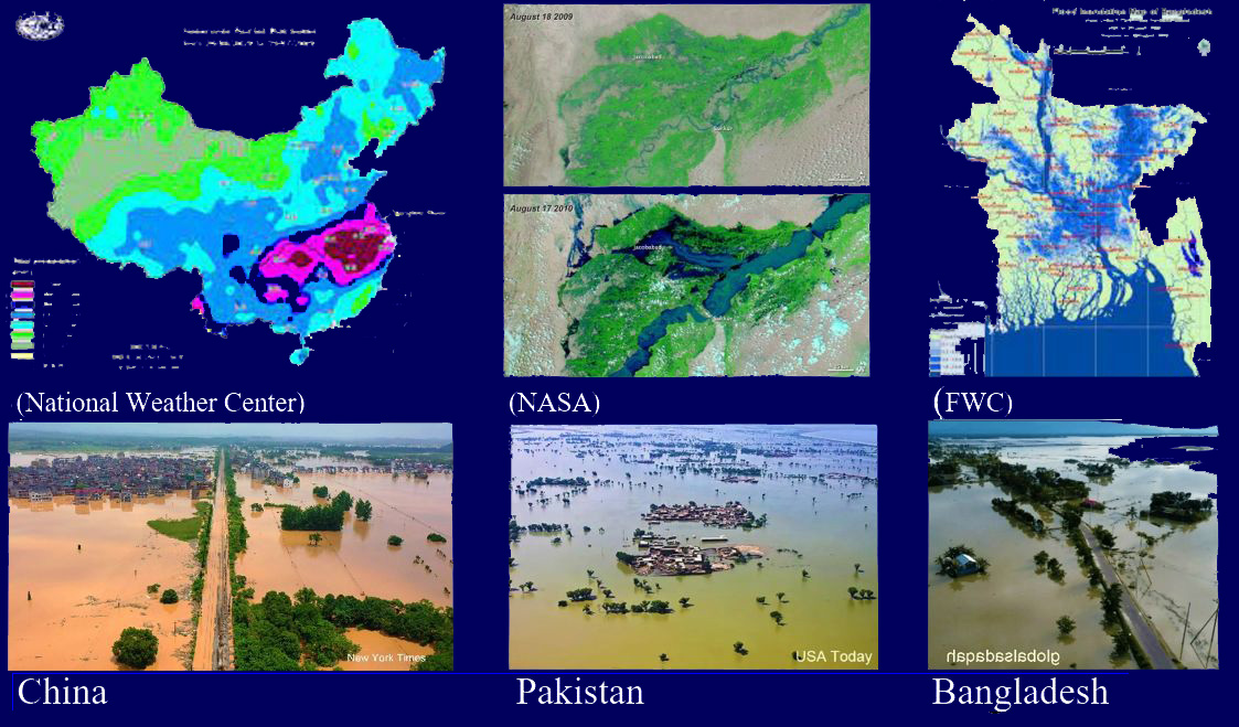
Before sea level rise itself becomes a problem, however,
global warming is being manifested now in an increase in
increased frequency and severity of storms and
floods. The year 2022 floods have vividly illustrated
just how inconvenient this truth has become. What is
clear is that climate change is a global problem now,
and that any waterfront planning and design must
incorporate an understanding of future flood and sea
levels.
2022 floods
|
|
|
Over the years the Waterfront Center has become an
influential voice in waterfront planning and design.
There is an opportunity now to use this voice to promote
“resilient” waterfront projects and plans that can
withstand the flooding changes that will certainly come
from global warming.
Monitoring Floods and Sea
Level
Predictions about the extent and rate of increase of sea
level and flooding vary depending on the model used and
the rate of carbon emission reduction.
|
|
|
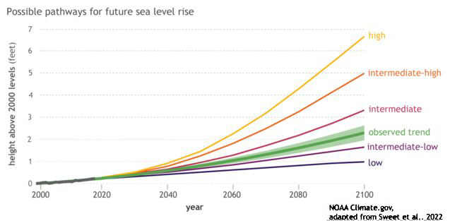
Possible Sea Level Rises
|
|
|
Current expectations are that the most likely trend is
the intermediate, with a sea level rise of about three
feet. The observed rate of global warming, however, has,
to date, exceeded the fastest predicted rate so this
expectation may be low. On a pathway with high
greenhouse gas emissions and rapid ice sheet collapse,
models project that average sea level rise for the
contiguous United States could be 7.2 feet by 2100 and
13 feet by 2150.
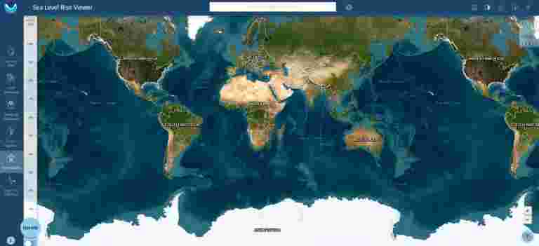
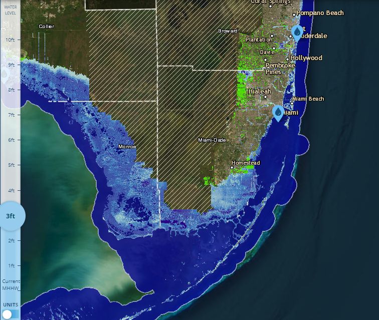
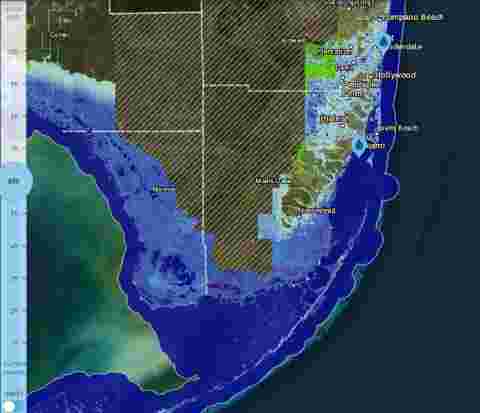
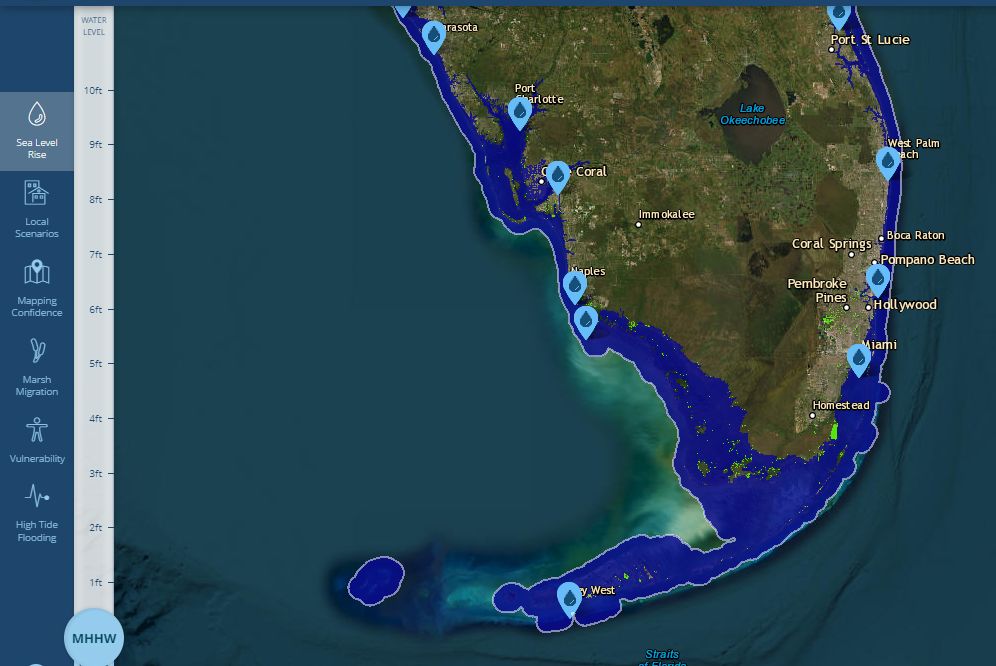
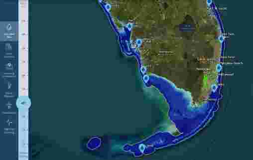
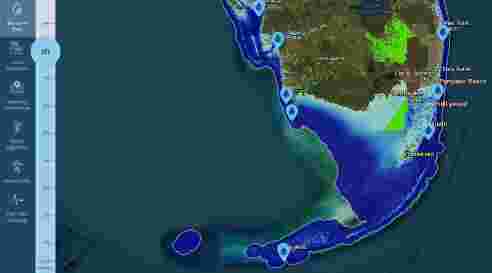
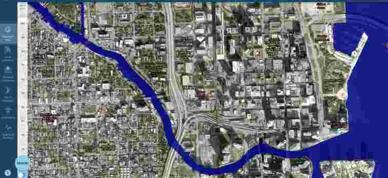
There are a number of
websites that have general predictions of sea level rise
(see Appendix) and
two that offer detailed interactive displays of sea
level rise and coastal flooding. These offer useful
tools when considering the resilience of waterfront
projects and plans.
|
|
|
Criteria For Waterfront
Climate Change Planning and Design
|
|
|
The
Waterfront Center currently has six criteria when
judging waterfront plans and designs: Sensitivity of the
design to water, Quality and harmony of design, Civic
contribution, Environmental, Enrichment, and Degree of
difficulty. Given the importance of flooding and sea
level rise, a seventh criterion should be added:
Resilience to climate change. This criterion should be
given great weight since, unless proposals can resist
future inundation, their other virtues are irrelevant.
What resilience means in the context of waterfront plans
and projects will vary but there are some general
guidelines. First and most important is location. One of
the great planning mistakes of the past was to place
development in the path of future flooding. In almost
all future scenarios, for example, the barrier islands
of the Atlantic US coast will be under water. No amount
of beach restoration or raised structures will save
them. It was always folly to build on these shifting
sand bars. Native American predecessors did not even
pitch teepees on them. There is also a great reckoning
coming for New Orleans - elevating levees cannot forever
protect the city against rising sea level and the
preference of the Mississippi River for an easier path
to the sea.
If
waterfront projects must be placed in the path of future
flooding to offer protection for past development that
cannot be moved, there are solutions but they are
temporary and very expensive. The Thames barrier in
England protects against flooding of the London subway
system, but at a cost of almost two billion dollars. To
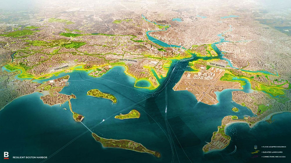
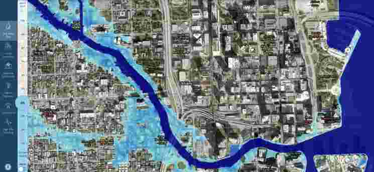
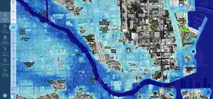
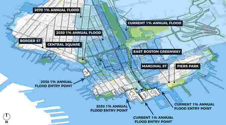
build flood barriers for Boston Harbor would cost
between $6.5 billion to $11.8 billion. A general rule
should be to avoid building in future flood prone areas
and to preserve these areas for wetlands, beaches, dunes
and other storm mitigation measures.
|
|
|
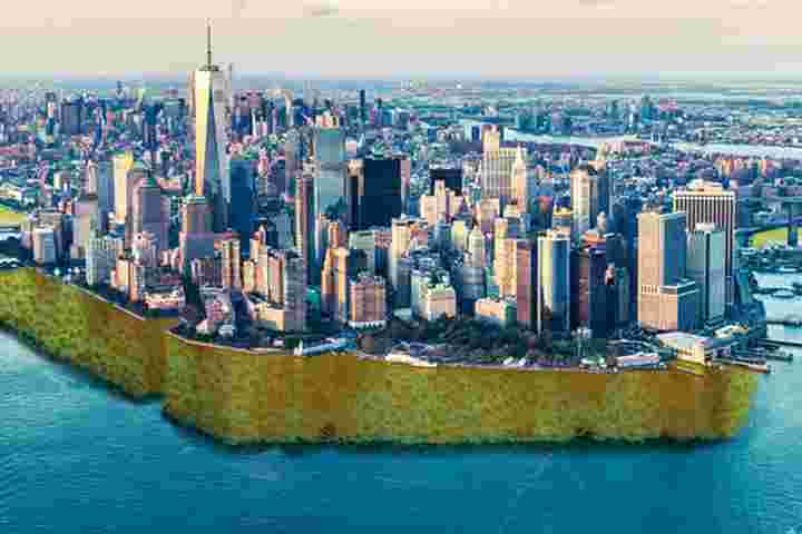
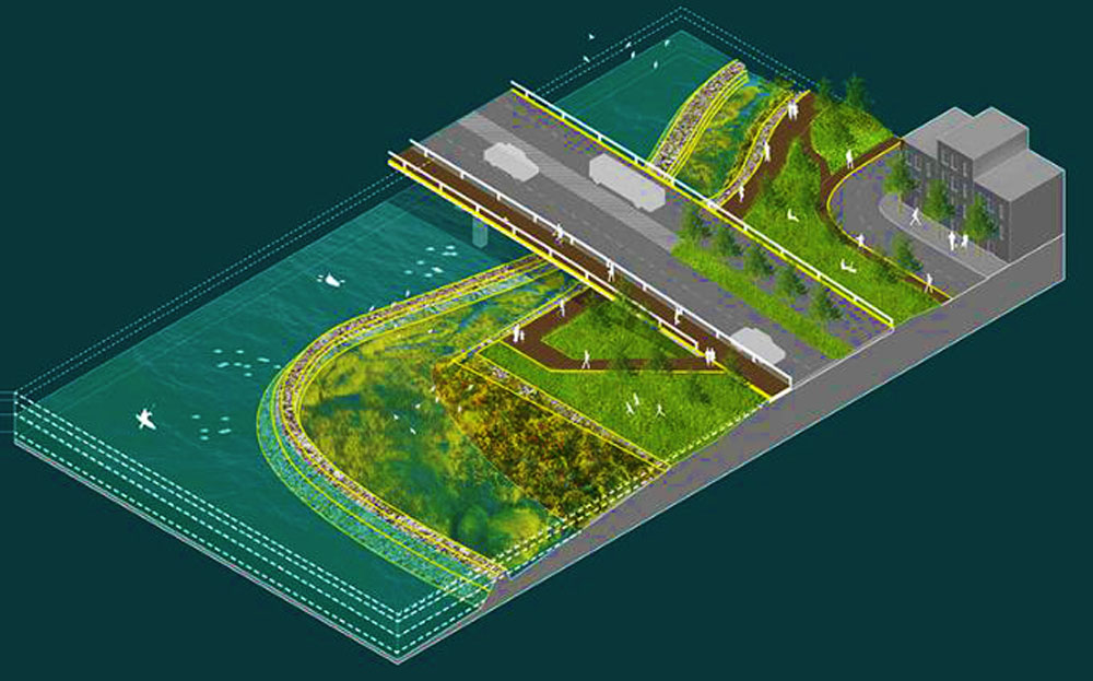
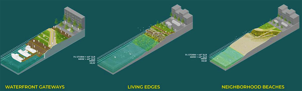
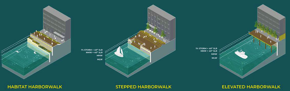
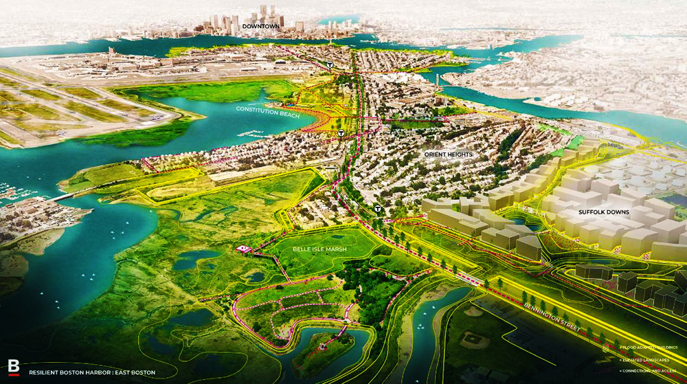
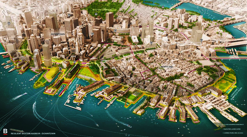
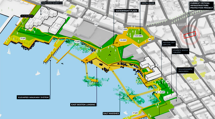
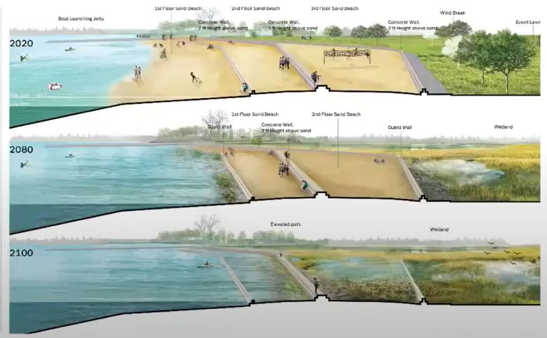
Example of Climate Change Resilience Plan
|
|
|
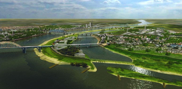
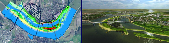
The Waterfront Center has included some awards in the
past to plans that clearly address the flooding increase
associated with climate change. In 2011 an award was
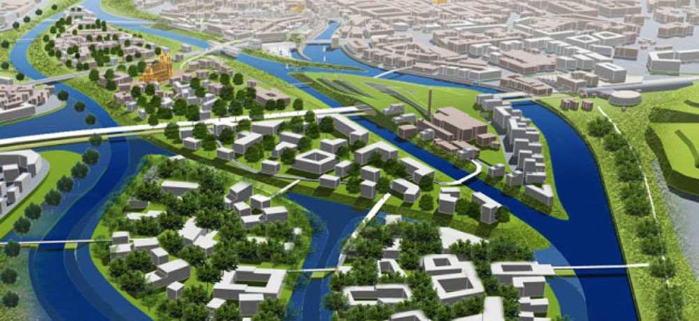
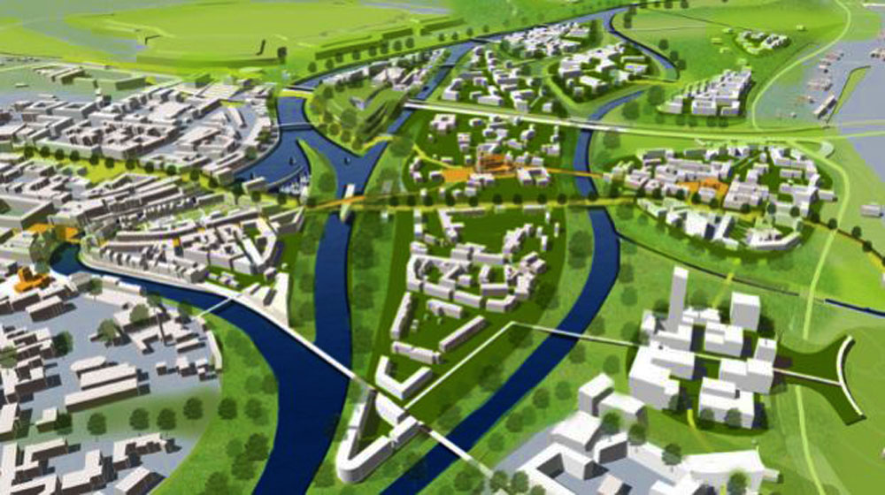
given to the Dutch city of Nijmegen for a plan titled
Room for the River Waal.
This is a good example of the kind of project that this
paper recommends for future promotion.
|
|
|
Plan and aerial view of flood storage for the River Waal
|
|
|


.jpg)