The Waterfront Center announces winners of the 2018
“Excellence on the Waterfront” Program
The Excellence on
the Waterfront Awards Program was initiated in 1987 with grants from the
National Endowment for the Arts Design Arts Program and the National Marine
Manufacturers Association. The honor awards were developed to recognize top
quality design and development work. Entries are accepted from around the world
for comprehensive plans, built projects and student work. The Center also
recognizes citizen’s efforts through a Clearwater Award named for the
non-profit group of that name working to clean up the Hudson River in New York.
Criteria
An interdisciplinary jury of professional planners, designers, city officials, and community, business and development representatives determine the awards using the following qualitative criteria:
Sensitivity of the design to water. Document how the entry makes use of the waterfront and water resource, how it provides active public enjoyment of the waterfront and physical and visual access to and along the waterfront.
Quality and harmony of design. Show how the entry its its natural or man-made surroundings, and incorporates the unique historic and cultural features of the community, particularly as they relate to the waterfront. The human scale of the project/plan is also a consideration.
Civic contribution. State how the project has helped the economy of the community, boosted civic pride or has otherwise had a positive affect on the area. Show how the work is sustainable and how it is economically viable over the long run.
Environmental values. Show how environmental values are stressed. This aspect and the importance of sound science is very important to juries.
Enrichment. Show how the project or plan contributes to the cultural richness of the community. Where applicable, relate how it provides interpretive information, art or facilities to explain an area's waterfront heritage and natural values.
Degree of difficulty. Describe how natural, political. jurisdictional, economic or permitting obstacles were overcome.
2018 Waterfront Center Award Winners
HONOR AWARDS:
Category: Top Honor Project
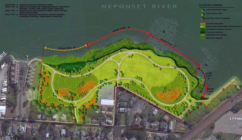
Senator Joseph Finnegan Park at Port Norfolk Boston, Massachusetts
Entrants: Iris Lin, Halvorson Design Partnership,
Dan Driscoll, Massachusetts Department of Conservation and Recreation Boston, Massachusetts
Project Description
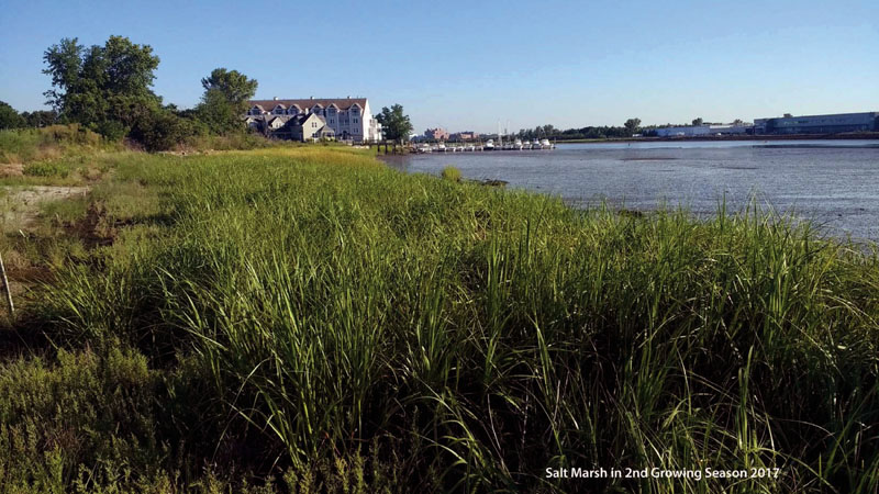
The Senator Joseph Finnnegan Park at Port Norfolk
represents the transformation of contaminated industrial land into neighborhood
open space and river access The park serves as a critical link between the
Neponset Greenway and the Boston Harborwalk. Most importantly, it restores the
shoreline to its native saltwater habitat.
The site,
14 acres along the Neponset River, was industrial land and a dump site for
hazardous waste since the mid 1800s. After the factories closed in the early
1980s, the Massachusetts
Commonwealth purchased the site and charged its
Department of Conservation and Recreation to clean it up, restore its sensitive
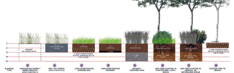
marshlands and provide public open space. Thirty year later, removal of
contaminated soils, invasive vegetation and decayed trees, surface debris,
deteriorated bulkheads and sea wall, and construction debris has created a large
open naturalized slope leading down to a restored salt marsh at the river's
edge.
Paths meander through the meadow and existing
woodland where benches provide respite Three interpretive panels document the
cultural environmental and industrial history of the site Thanks to persistent
citizen activism neighborhood commitment and an ambitious but simple restoration
strategy the park provides multiple access points to the water from the
neighborhood, and
illustrates how hard work and expertise in habitat
restoration can transform a long-standing contaminated site into a local jewel
along the river.
The jury found little "stuff"
associated with the project, a naturally elegant park.
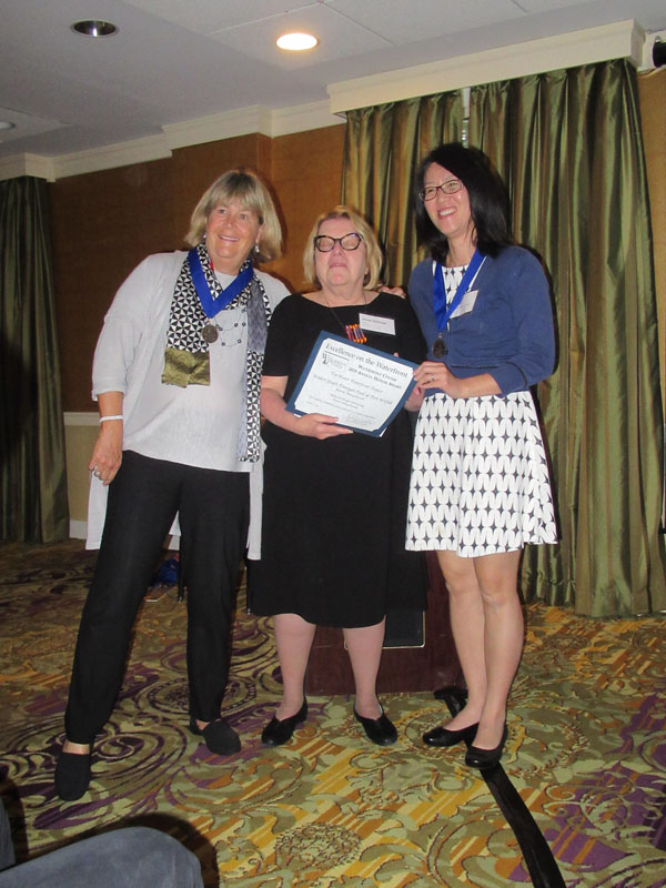
Iris Lin and Cynthia Smith receive the award
Category: Top Honor PLAN
Willamette Falls Riverwalk Master Plan, Oregon City, Oregon
Entrants:
Laura Terway, Metro and City of Oregon City
Carol Mayer-Reed, Mayer/Reed,
Inc. Portland, Oregon
Project Description
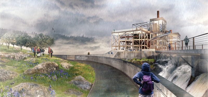
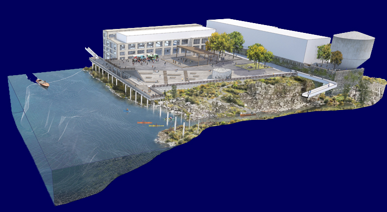
The Riverwalk Master Plan celebrates Willamette Falls, the second largest waterfall by volume in the US. It recycles 22 acres of idle mill infrastructure into new commercial, cultural and interpretive uses, and restores riparian and fish habitat and wetlands alongside a hydroelectric dam. More importantly, it includes a Riverwalk that provides a strong vision for the site and establishes its public realm . It allows visitors to move up, down and through the site and to the river using a series of islands as stepping stones formed by the dam's intake basin. Elevated pedestrian paths weave across public plazas, along wetland edges and through buildings all the way up to historic smokestacks that offer 360-degree views of the dam, river and Oregon City environs. Visitors can also walk to the top of the falls where an overlook places them "in the midst of the spray, wind and rush of the waterfall".
The Riverwalk also serves as a portal into Oregon history through layers of geologic and cultural depth. Walkways slice through the geologic strata of the site and provide intimate encounters with its basalt bedrock. Below it, visible inlets and rock outcroppings provide resting habitats for migrating salmon.
The combination of public access to the river, restored riverine habitat, historic and cultural interpretation activities and economic redevelopment for Oregon City embrace the four core values established in the 2012 Vision Framework, and honor the tribal, county, regional, city, non-profit and citizen partners long engaged in the project.
The jury thought this submittal thoroughly documented and beautifully presented, including its comprehensive science, and a "robust" public process that involved 1200 participants and a special Tribal Advisory Board representing five tribes with historic connections to the river and area.
Jeramie Shane, Mayer/Reed Inc. and Matt McMahon,Snohetta receive the award
Category: Park, Walkway, Recreational Honorr
Entrants: Weintraub Diaz, Landscape Architecture,
Nyack, New York
The Trust for Public Land, Newark, New Jersey
Project Description
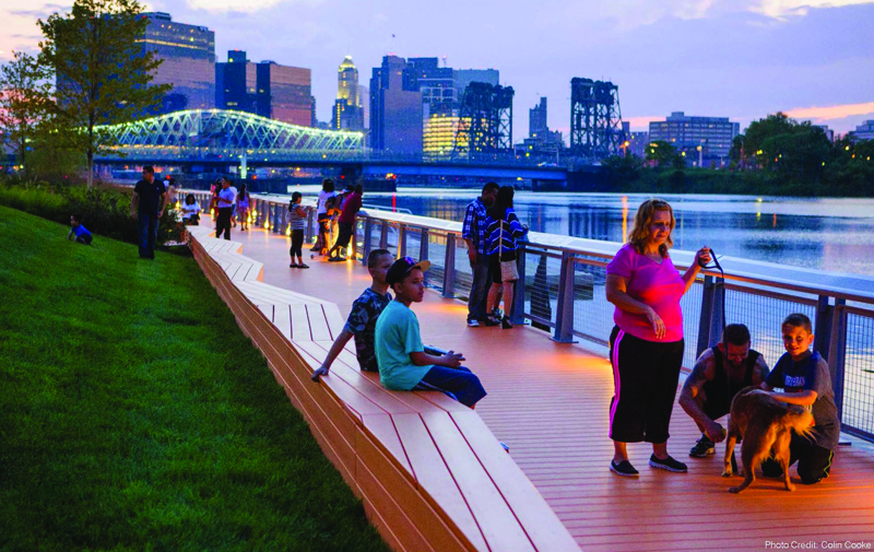
Newark Riverfront Park is the most recent phase undertaken by the City of Newark to reclaim the Passaic River's waterfront for public use and recreation. Located in the Ironbound area of the city, a vibrant and diverse Portuguese/Brazilian/Central American neighborhood, the park adds important water access and park space to an under served community, and connects them to existing ball fields, county and city parks along the river.
The park sits atop a former Superfund site. Smelting and chemical factories produced toxic chemicals (e.g. Agent Orange) and refinery materials from the 1920s. While community interests had focused on environmental justice issues for many years, it was only when a fire destroyed the chemical plant in the early 1980s that the same interests galvanized around the development of a riverfront park.
Funding from the National Endowment of the Arts (NEA) and an energetic outreach program with residents, including 'walkshops', boat trips along the dilapidated riverfront, and several public workshops resulted in a publicly-driven plan for the park focused on an embrace of the neighborhoods racial diversity and the need for water access.
The plan includes 9 blocks of tree-lined meandering paths, a colorful orange waterfront esplanade, seat walls, a floating dock for use by canoers and kayakers, a performance space for multi-cultural events, ball fields, quiet spaces for solitude and meditation, an art garden, and interpretative signs that document the site's evolution. All park construction materials are recycled. Elevated pathways, including the promenade and seating respond to periodic flooding, as does the native and adaptive riparian vegetation that infiltrates and absorbs stormwater.
The park is part of a strategy for public space planned along 19 acres of the
riverfront, which will eventually connect to downtown Newark. It is a model of
successful collaboration between government, environmental justice advocates,
the local neighborhood, and funding sources. It also illustrates how
environmental restoration
combined with park development can create valuable
urban open space infrastructure and economic investment.
The jury was impressed with the park's transformation from a degraded Superfund site and the scale of public input into its vision .
Len Hopper and Weintraub Diaz receive the award
Category: Environmental Protection, Enhancement
Refuge Gateway and Humbug Marsh
Entrants:
John Hartig, US Fish and
Wildlife Service, Grosse Isle, Michigan
A. Hicks, Hamilton Anderson Associates, Detroit,
Michigan
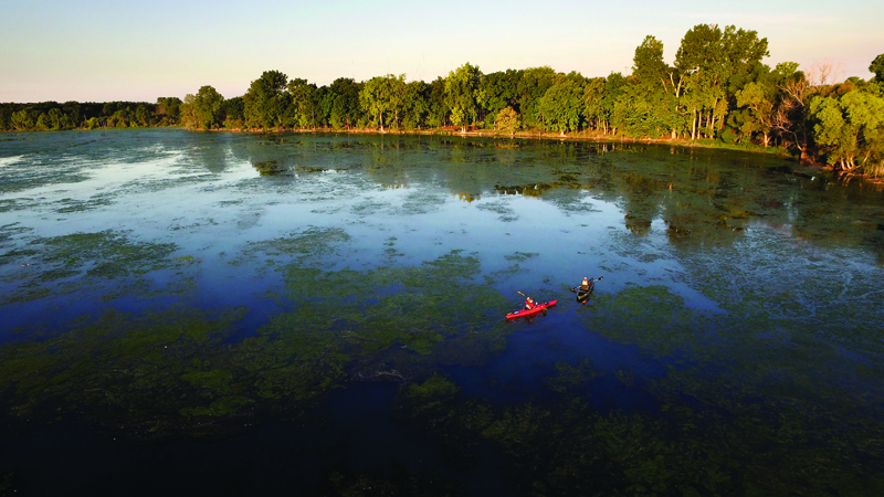
Project Description
Established in 2001 , the Detroit River International Wildlife Refuge is the only global refuge in North America and one of only 14 priority urban refuges in the nation charged with bringing conservation initiatives to urban areas. It covers 48 miles of river and lake shoreline along the Detroit River and Lake Erie, habitat for over 350 species of bird and 117 species of freshwater fish within the larger Great Lakes Basin Ecosystem. The US Fish and Wildlife Service, Michigan Department of Natural Resources and southwestern Ontario agencies cooperatively manage conservation of the Refuge's shore lands and recreation activities for over 7 million people living within a 45-minute drive of its borders.
The cornerstone of the refuge is the Humbug Marsh - 410 acres along the last river mile of natural coastal marsh habitat within the Great Lakes Basin ecosystem (including the Detroit River) in the US mainland, and the only Wetland of International Importance in Michigan in the Ramsar Convention. Humbug Marsh is home to multiple unique and imperiled native species of birds, fish , plants, insects, and reptiles.
Interestingly, the Marsh is adjacent to a former auto manufacturing facility that produced brakes, paints and solvents for over 44 years. After some cleanup it sat vacant for over a decade. In 2002, Wayne County Parks bought the brownfield as the future home of the Detroit International Wildlife Refuge and continued to clean up the site for use as a conservation and public recreation area. Site cleanup was ambitious - 16 acres of new wetland, 25 acres of new upland habitat; creek daylighting, and removal of over 55 acres of invasive species.
The site, now called Refuge Gateway, also includes public facilities - a LEED-certified visitor center, a docked educational school ship, fishing piers, a canoe/kayak launch, wildlife observation decks, hiking trails, outdoor classrooms and connections to over 100 miles of city greenways. The Gateway has also merged with the Marsh and serves as a green buffer for the Marsh's more sensitive areas.
Refuge Gateway and Humbug Marsh are transformational for Detroit. It is turning it from a rust belt city into the host of a globally significant and protected ecosystem. The project has reconnected residents with their natural resources and laid down standards for collaborative leadership in stewardship initiatives.
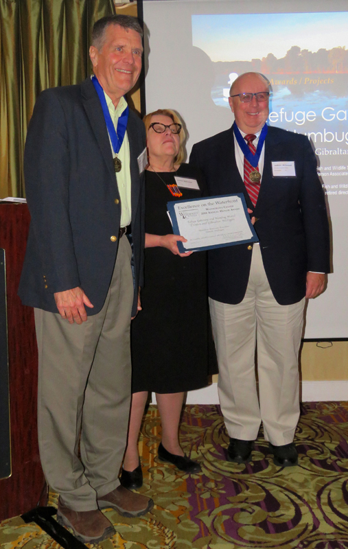
Andrew McDermott, U.S. Fish and Wildlife Service, Bloomington, Michigan
and John Hartig, retired director of the Humbug Marsh, receive the award
Category: Park, Walkway, Recreational Honor
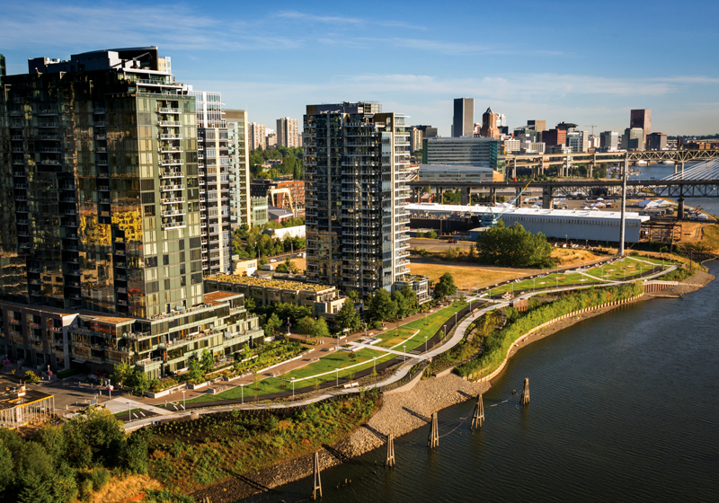
South Waterfront Greenway, Portland, Oregon
Entrants:
Chelsea McCann, Walker Macy, Portland, Oregon
Thomas Balsley, Thomas Balsley, New York, New York
Project Description
Portland’s South
Waterfront Greenway provides pleasant public walking and bike trails along the
Willamette
River through a 130-acre former brownfield site, now one of
Portland's highest density and most innovative
urban neighborhoods - one that
interweaves housing with commercial, research, education, recreation, park and
river restoration activity. The Greenway currently covers a 1.2-mile segment of
the larger Willamette Greenway and is envisioned to connect multi-modal
pedestrian, cycling and green corridors along the river throughout Portland.
For the past
fifteen years,two landscape architecture firms, with support from engineering
partners, have led the Greenway design process from early master planning to
completion of the 4.3 acre Central District park, the now
completed trail
segment, riverbank restoration and river access.
Unique
components of the design include: an expanded 100 foot setback from top of bank
(usually 25 feet); the
use of industrial materials for fencing and public
art, remnant piers that recall the area's industrial past, and "lawn
shelves"
for sitting. Terraced river banks with honeycombed concrete planting vaults
filled with native and climate adaptive plants protect the riverbank during high
and low water levels. Public art commemorates Native
American and local
industrial history. Stormwater swales and filter elements clean rainwater and
release it slowly all along the riverbank. Loose gravel laid along the lower
riverbank makes shallow water habitat for salmonids and lamprey.
Renaturalization of the site uses native trees and shrubs to provide roosting
and foraging areas for migratory birds. Small overlooks allow bird and habitat
watching without disturbance.
So far the Greenway has proven to be one of the most highly used public spaces in the South Waterfront district, and serves as a "living room" for its residents.
The jury found the design of the riverbank to be particularly beautiful.
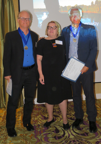
Mike Zilis, Walker Macy, and Thomas Balsley, Thomas Balsley Associates, receive the award
Category: Artistic, Cultural, Educational
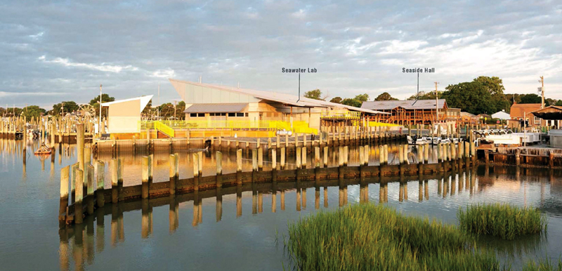
Virginia Institute of Marine Science (VIMS) Campus Plan
Entrants:
Donna Phaneuf, VIA design architects, Norfolk,
Virginia
and Dr. Richard
Snyder, VIMS, Wachapreague, Virginia
Project Description
Virginia Institute of Marine Science (VIMS), one of the leading marine research and education centers in the US, maintains an integral presence in the coastal community of Wachapreague, Virginia. The Wachapreague research base extends from inland watersheds to the open ocean, with an emphasis on the coastal zone. The three-part mission includes the conduct of research, education of citizens and students, and the provision of advisory services to policy makers, agencies, industry and the public.
The Eastern Shore Campus Master Plan, completed in 2010, includes nine buildings overall, which will respond to the town and water, the need for public access to the campus' water edge, and the technical requirements for future campus growth.
Two buildings have been completed to date. The Eastern Shore Lab provides large-scale space for experiments and research. Seaside Hall - serves as the on land laboratory facility and the education and lecture hall.
The new Seawater Lab is an 8,000 sq. ft. structure that
provides open clear-span space adaptable to different research efforts. 10 foot
high concrete foundations form the buildings' base, with floodgates and shields
providing
storm surge protection up to state and FEMA requirements (14+
feet). The concrete base supports a superstructure of parallam and microaim
timbers to form a shed roof, which mimics local barn structures in order to help
the large building 'fit' into its rural seaside setting on Wachapreague Channel.
Seaside Hall mimics the historic town's vernacular in facade style, proportion, screen patterns and roof forms. The building is elevated out of the flood plain on piles like the local piers. Front Porch, a screen porch creates usable outdoor space for students while embracing the elegant forms of their neighbors.
The entire campus is water-oriented, designed to resist
storms and facilitates the Institute's commitment to understanding natural
processes. Both buildings are simple in design and in the use of materials
appropriate to their setting.
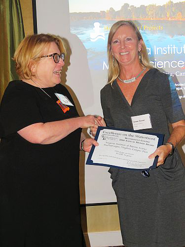
Donna Phaneuf, VIA Design Architects, receives the award
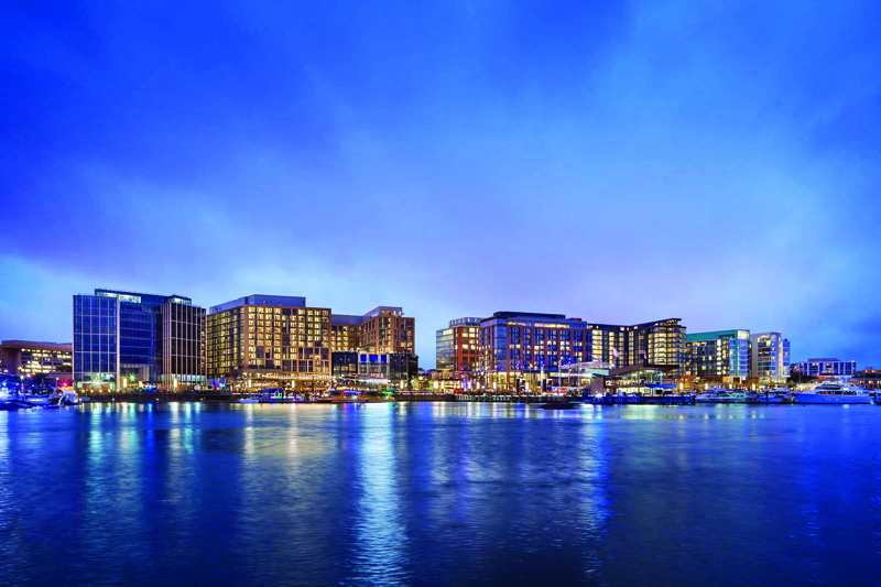
Category: Commercial, Mixed Use
Entrants:
Mathew Jahromi, Hoffman Madison Waterfront,
Washington, D.C.
and
Justin Wolf, Perkins Eastman, New York, New York
Project Description
The Wharf is a
major mixed use development located on the Washington Channel, which empties
into the confluence of the Anacostia and Potomac Rivers in Washington DC. It
replaces a dated 1960s urban renewal project. The largest planned unit
development (PUD) waterfront development in Washington DC in the last 50 years,
it includes: 10 acres of open space, public promenades, a diverse mix of
housing, shops, restaurants, hotels, office buildings, and a 6,000 seat indoor
theater. A unique streetscape along the waterfront safely mixes, pedestrians,
cyclists and cars. The Wharf emphasizes active water use. Docks and programmable
piers accommodate those traveling to the Capital via boat, and ' the
‘Dockmaster' a concert, performance and
gathering venue, extends 400 feet
into the Washington Channel.
The surrounding
historic urban fabric, ecology and economy of Southwest Washington drive the
design, creating what is hoped to be a vibrant community along the waterfront in
this part of the city. Round the clock public waterfront access and a robust
calendar of free public events encourage integration with the loca
community.
Environmental sustainability is also a key concept behind The Wharf. The entire area is designed to achieve LEED-Neighborhood Development Gold certification and to exceed the District's Green Building Act and the Anacostia Waterfront Initiative standards. Natural gas micro-turbines and green and highly reflective roofs on buildings should result in significant reductions in energy and potable water use. Cisterns, permeable paving, on site stormwater collection techniques, diverse native vegetation, floating wetlands, and extensive tree planting, create the environmental management framework for the site.
The Wharf illustrates how a public private partnership worked for over 11 years through hundreds of community meetings, four Acts of Congress, and in coordination with multiple local and national agencies to implement the plan. Phase One opened in October 2017 at a cost of $2.5 billion.
The jury praised the high quality of the buildings and their design.
Shawn Seaman on behalf Hoffman-Madison Waterfront for District Wharfs, receives the award
Category: Long Range Plan Honor
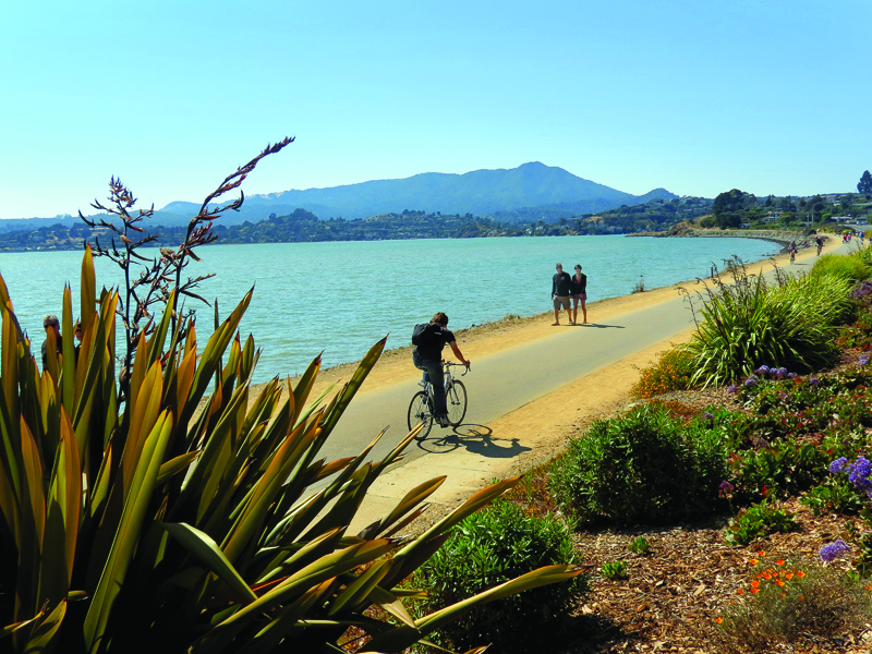
San Francisco Bay Trail Design Guidelines and Tool Kit
Entrants:
Lee Huo, Association of Bay Area Governments, San
Francisco, California
and Patrick Miller Landscape Station, Berkeley, California
Project Description
San
Francisco Bay is the dominant waterfront and open space amenity of the Bay Area.
Since the late 1980s,
a
major trail has been slowly developing as a continuous pedestrian, bike and
recreation amenity encircling the Bay and its various landscape and urban
settings. Once completed at 500 miles in length, the San Francisco Bay Trail
will be the longest single urban recreation and transportation route in the US.
It will connect the waterfronts of 9 counties, 47 cities, over 130 parks and
urban open spaces, and cross 7 toll bridges. Over 2.5 million residents living
within 2 miles of the trail will benefit directly from it, along with
approximately 7 million residents in the
greater Bay Area, not to mention visitors.
Approximately 350 miles of the trail are complete in various places around the
Bay, but many challenging gaps in the last 150 miles remain. The San Francisco
Bay Trail Design Guidelines and Toolkit provides guidance and information on how
to plan, design and implement these gaps or improve existing segments in a way
that
makes the Bay Trail
identifiable along its route. It includes: the Bay Trail story and its values, a
consistent design approach, principles and objectives for implementation, an
inventory of typical users in order to plan safe user experiences, and a Toolkit
of technical information and solutions.
The Toolkit covers issues such as sight lines, trail width and surfaces, constrained rights of way, speeds, levels of use, compatibility with wildlife, connections, water access, trail wayfinding , etc. It also provides a "gallery of settings" to help planners, agencies and advocates envision how to implement trail segments in their communities in a manner consistent with the overall quality of the Bay Trail.
The gallery illustrates how to integrate urban land uses
and parks, wildlife habitats, and trail connections in specific conditions such
as on levees, boardwalks or promenades, through plazas, along streets and
through street crossings, over bridges, across highways, etc. The guide is full
of valuable information for planners and
advocates alike, provides clear
images that illustrate issues and concepts, and is easy to read . Most
importantly, it articulates the philosophy of the San Francisco Bay Trail and
the design principles needed for consistent implementation of its vision.
"Very comprehensive, clear and concise."
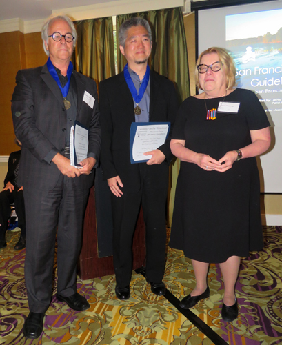
Patrick Miller, Landscape Station, and Lee Huo, Association of Bay Area Governments, receive the award
Category: Clearwater
The Clearwater Award is named for the group of
volunteers based in Beacon, New York, whose mission
was to help clean up the
Hudson River. The organization was formed by the late Peter Seeger
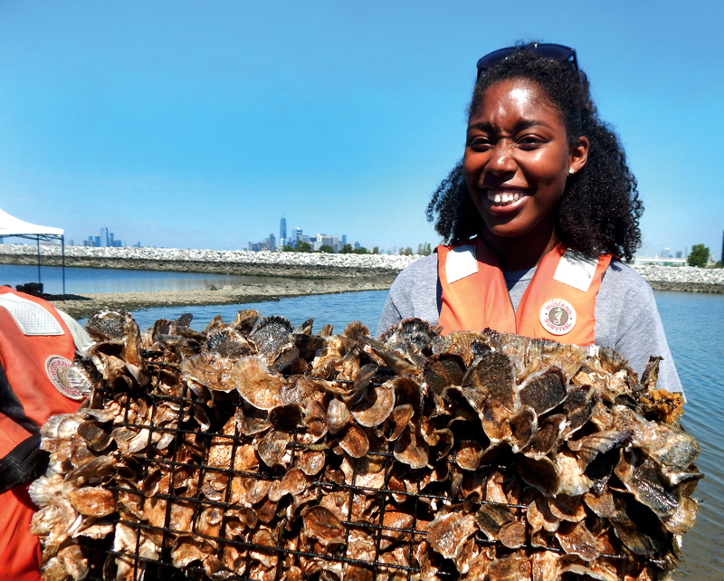
The Billion Oyster Project, Governors Island, New York
Entrants:
Michael Fishman, Stantec,
New York, New York
Recognizing Blyss Buitrago, community, stewardship and engagement manager,
The Billion Oyster Project, Governors Island, New York
Project Description
The Billion Oyster Project is a student project with
the New York Harbor School focused on restoring 1 billion live oysters in NY
Harbor by 2035 in at least 100 oyster reefs. The Project is the brainchild of
Murray Fisher
and Pater Malinowski, educators at the Harbor School, and is
modeled after the successful Chesapeake Bay Recovery Program.
Formally established in 2014, the Billion Oyster Project hopes to engage thousands of middle and high school students and citizen volunteers in replanting the oysters, thanks to a $5 million dollar National Science Foundation grant.
The intertidal oyster is a native keystone species throughout the Hudson River estuary, which includes New York Harbor. Noted for filtering water, attenuating wave and boat wake energy and facilitating fish and other habitat, it was prolific until the early 1900s when over harvesting, harbor dredging and pollution rendered it extinct.
The Project teaches students about the oyster and its ecological significance, and how to use discarded shells from area restaurants to grow new oysters in gabion beds, which lay the infrastructure for new reef habitat in the harbor.
Over 70 local restaurants have organized the Oysterhood Shell Collection Program, which recycles the shells for the students to use in growing the oysters. More than 400 gabions have been installed in the Hudson, especially under the Tappen Zee Bridge. As of 2015, 11 .5 million oysters were harvested in the harbor and 1 acre of reef restored. Harbor water quality has also improved.
The Clearwater Award recognizes the efforts of these volunteers and also acknowledges the engineering services of AKRF, Inc., and the Hudson River Foundation and University of New Hampshire's research assistance.
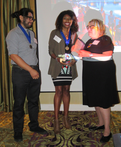
Juan Pareja and Blyss Buitrago receive the award
Ann Breen and Dick Rigby are the co-founders and co-directors of the Waterfront Center, organized in 1981.
For additional information and photographs, contact:
Ann Breen
The Waterfront Center
PO Box 32129
Washington, DC 20007
202-337-0356 Fax: 202-986-0448
©
2007 The
Waterfront Center
Content and photographs on this site may not be reproduced without express
permission from The Waterfront Center.
